photo sharing and upload picture albums photo forums search pictures popular photos photography help login
taboo5 | profile | all galleries >> Ireland >> Cliffs of Moher, Ireland (December 2013) tree view | thumbnails | slideshow

Cliffs of Moher, Ireland (December 2013)

The Cliffs of Moher are Ireland’s biggest tourist attraction, attracting close to one million visitors per year. They are located at the southwestern edge of the Burren region in County Clare, Ireland. They rise 120 meters (390 ft.) above the Atlantic Ocean at Hag's Head. The cliffs reach their maximum height of 214 meters (702 ft.) just north of the round stone O'Brien's Tower near the midpoint of the cliffs. The Cliffs of Moher take their name from a ruined promontory fort “Mothar,” which was demolished during the Napoleonic wars to make room for a signal tower. Many movies have been shot at the Cliffs of Moher, including “Harry Potter & the Half Blood Prince” in 2007. Any visit to Ireland would be incomplete without a visit to the Cliffs of Moher.
Cliffs of Moher, Ireland cover page.
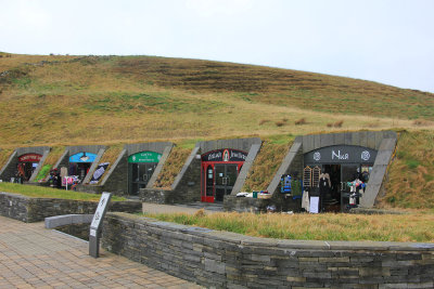
Tourist shops near the parking lot and Visitors Center for the Cliffs of Moher.
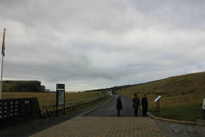
Road that leads to the cliffs.
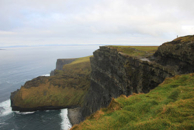
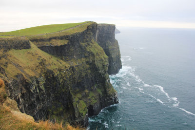
The Cliffs of Moher stretch for 8 kilometres (5 miles) along the Atlantic coast of County Clare in the west of Ireland.
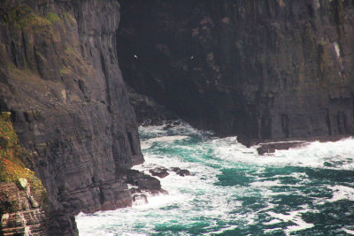
Turgid water at the cliffs. They stand at 214 meters (702 feet) at their highest point.
Craggy coastline along the cliffs.
The cliffs consist mainly of beds of Namurian shale and sandstone.
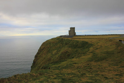
View of O’Brien’s Tower, which marks the highest point of the Cliffs of Moher.
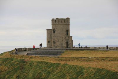
Built in 1835 by local landlord Cornellius O'Brien as an observation tower for tourists and to impress women he was courting.
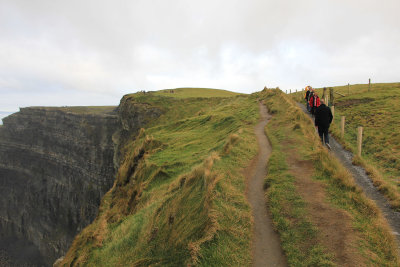
The Burren Way trail links the villages of Liscannor and Doolin.
The Burren Way trail is 71 miles long and crosses the Burren, one of the largest karst limestone landscapes in Europe.
The rock below is called the Needle.
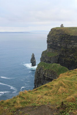
The rock below is called "the Needle."
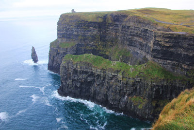
Another view of the Needle. O’Brien’s Tower is in the background.
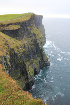
A horizontal view.
A horizontal view.
The walking path from Cliffs of Mohar viewing area for 8 kilometers is called hags head.
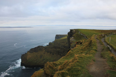
The walking path from Cliffs of Mohar viewing area for 8 kilometers is called "hags head."
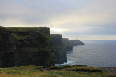
The cliffs in perspective with a foggy mist.
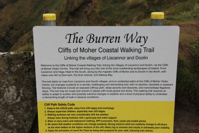
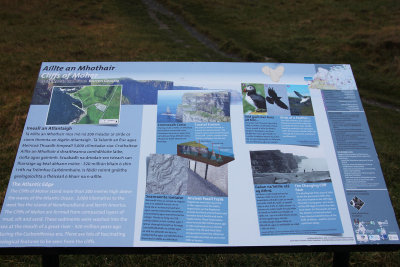
Informational sign for the Cliffs of Moher.
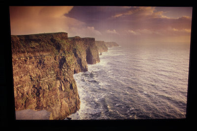
Photo of the cliffs in the Information Center.
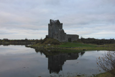
Near the Cliffs of Moher is Dunguaire Castle.
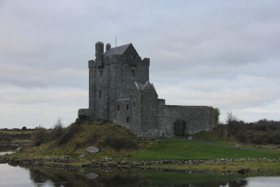
It was built in 1520 by the O’Hynes clan on Galway Bay. It was restored in the 20th century.