photo sharing and upload picture albums photo forums search pictures popular photos photography help login
Subrata Basu | profile | all galleries >> belize >> xunantunich_stone_woman tree view | thumbnails | slideshow
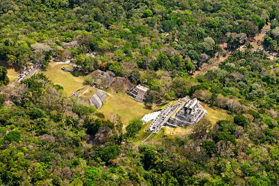
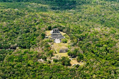
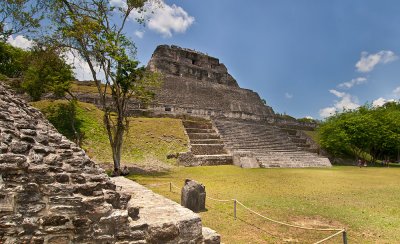
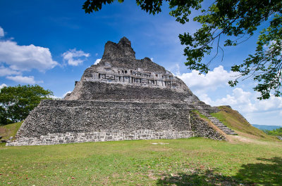
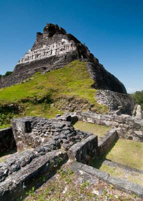
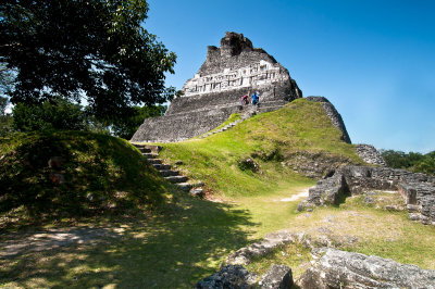
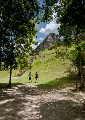
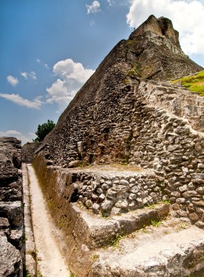
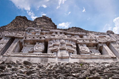
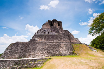
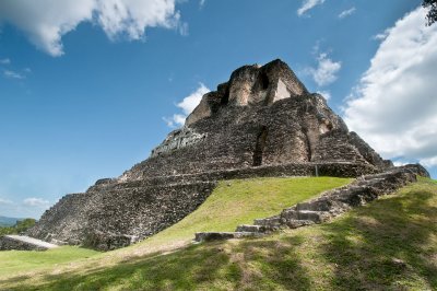
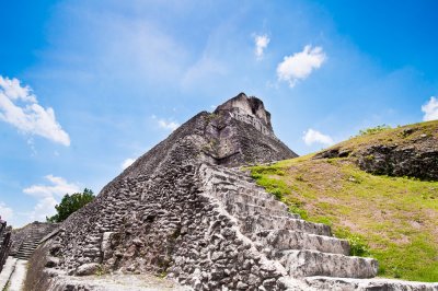
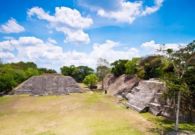
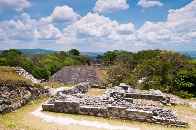
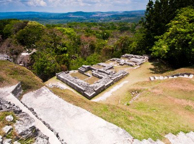
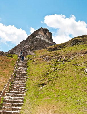
Maya archaeological site, Xunantunich (shoo-Nahn-too-nich), is located on a mountain ridge along the Mopan River, approximately 80 miles west of Belize City in Cayo district, within sight of Guatemala boarder. Most of the structures were built during the Maya Classic era (about 200 to 900 AD). The core consists of several plazas surrounded by temples and palaces. A pyramid shaped structure known as “El Castillo” which stands at about 130 feet tall, making it the second tallest structure in Belize (after the temple in Caracol). The name Xunantunich means “stone lady” in Mayan language. It is believed that it refers to a ghost of a lady who descends from the El Castillo in all white with fiery red eyes and then disappears into a stone wall.
previous pagepages 1 2 ALL next page
g4/52/512452/3/145289080.0vulFADS.jpg g4/52/512452/3/145289081.MrGmznyL.jpg El Castillo g4/52/512452/3/135181253.G8yn4QZh.jpg
g4/52/512452/3/142409791.k662y5Xd.jpg g4/52/512452/3/142409794.ar75IdWw.jpg g4/52/512452/3/142409792.aLJswXZW.jpg g4/52/512452/3/135115211.M3EkzjhS.jpg
g4/52/512452/3/135181254.sHeKwsLY.jpg g4/52/512452/3/135181255.q6a8JEQ7.jpg g4/52/512452/3/142409793.kCfMRShT.jpg g4/52/512452/3/135284305.0UQ4dqC4.jpg
g4/52/512452/3/135284306.7zYvouic.jpg g4/52/512452/3/135284307.GBFsMzsV.jpg g4/52/512452/3/135284309.TPOKrsaA.jpg g4/52/512452/3/135115210.HTFEpe1d.jpg
previous pagepages 1 2 ALL next page