photo sharing and upload picture albums photo forums search pictures popular photos photography help login
Sabahattin Bilsel | all galleries >> thematics >> cistern/sarniç >> konacik > girelaltı
previous | next
14-Feb-2009

girelaltı

view map

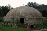
Kazderesi'nden Girel'e doğru kuzeye giden orman yolunun sonunda
37°05'01"N , 27°21'54"E

kitabe

(iki mahallenin sınırında olduğu için, aynı foto Gölköy albümünde de var)

Nikon D70
1/250s f/8.0 at 31.0mm iso200 full exif

other sizes: small medium large original auto
previous | next
comment