photo sharing and upload picture albums photo forums search pictures popular photos photography help login
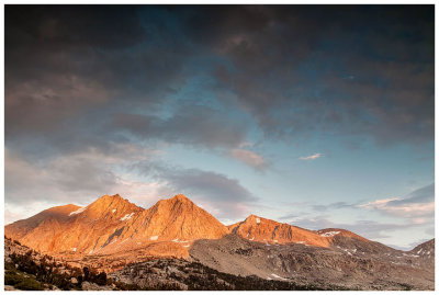
Steve, Katherine, and Norah | profile | all galleries >> Galleries >> John Muir Trail 2017 tree view | thumbnails | slideshow

John Muir Trail 2017

The short version:

In August 2017 we hiked about half of the John Muir Trail, starting at Horseshoe Meadows and hiking northbound to exit at Bishop Pass. We took twelve days to hike 120 miles with 23,478 ft elevation gain (and similar elevation loss). This included one rest day for Norah and I at Kearsarge Lakes while Steve hiked out for our resupply at Onion Valley.

Our highlight was hiking Mt. Whitney, our favorite campsite was Palisade Lakes, and the answers to our most common questions on the trail were: Norah is 9.5, no she isn’t carrying very much, yes her backpack is full of candy, the camera is an old dinosaur Canon 5D, and yes my camera gear is heavy. And the question we asked ourselves the most was “WHY DID WE BRING SO MANY (*#@&$^ ALMONDS?”.

All in all, we had an amazing trip - gorgeous scenery, dramatic mountains and passes, beautiful lakes, great weather, pudgy marmots and entertaining ground squirrels, Milky Way nights, prime campsites, and friendly hikers. Loved it!

Scroll down for pictures!

The long version:

Steve and I first visited the Sierra Nevada fifteen years ago when we backpacked the Rae Lakes loop. It was our first multi-day backpacking trip and we loved it. We always intended to get back to Sequoia and Kings Canyon National Parks (SEKI), we just didn’t realize it would take us this long to do so. After we failed to get a permit for the Wonderland Trail, we set our sights on SEKI and obtained a permit for a modified “Big SEKI” loop, including Mt. Whitney. The Big SEKI loop starts at Road’s End and travels 155 miles, including ~60 miles of the John Muir Trail (JMT). We had two weeks and planned to use the Colby shortcut to shave off some miles. This route was attractive to us because it included some of the best sections of the JMT, as well other less crowded but still scenic trails, and the logistics for a loop hike were easy. Steve sketched out a rough itinerary with the prime campsites, we evaluated our packing lists, and made plans for our resupply at Onion Valley. We were excited and ready to go!

But there was one snag in our plans. Snow. The Sierra Nevada snowpack in 2017 was 177% the historic average and the biggest in several decades. We had planned our trip for late August hoping we would be in the clear, but as we were obsessively checking trail conditions and water crossings as our departure date neared, we were getting increasingly nervous about several water crossings, particularly with Norah. After much discussion, consulting sources, and phone calls to the ranger stations, we decided the prudent thing would be to reconfigure our trip. From everything we read, the portion of the JMT we intended to do was okay, we just needed to approach it from the eastern side. Now we were back to our original problem of obtaining permits, which are very hard to come by for the JMT on short notice. We started making all sorts of plans and contingency plans for different walkup permit scenarios, but luckily we didn’t need them as Steve managed to snag a permit online that worked with our dates and resupply. *phew* We wouldn’t be hiking southbound like we had initially planned - we were heading north from Horseshoe Meadows to Bishop Pass/South lake - but we were happy to get a permit and would make it work. And we’re back on track!

The next step was figuring out logistics of a one way hike. We had already planned to rent a car in San Francisco, but had to figure out transport between the two trailheads. We looked at the available options and while none were very appealing, we ended up renting a second rental car at the Mammoth Lakes airport. Not the cheapest option, but under our time constraints it was the easiest and allowed us the most flexibility. We flew into San Francisco Friday evening, did a lot of driving on Saturday (we left a car at South Lake for our Bishop Pass exit), then started our hike on Sunday from Horseshoe Meadows. After all the rigamarole, we were happy to finally be on the trail.

The route we hiked was 120 miles with 23,478 feet elevation gain and 23,718 feet elevation loss. Steve had some extra miles (he did 131.8 miles with 27,023 feet elevation gain) as he hiked out from Kearsarge Lakes for our resupply in Onion Valley. With our flight schedule, we could use as many as fourteen days for the hike and we ended up doing it in twelve. We always like to give ourselves some extra margin for potential bad weather, a needed rest day, or in the case of this trip, some extra time due to the elevation (we were coming from sea level). The disadvantage of the route we did was that we would hit Mt. Whitney on Day 4 - so pretty quickly we would need to acclimate and feel ready for the big day. To avoid any problems from altitude, we knew we wanted to avoid overexertion and trying to do too much, so kept our first few days moderate to ease ourselves into the hike. We did have headaches the first few days, but nothing that Advil, taking it easy, and some good nights sleep couldn’t fix. Overall, we felt our itinerary worked well for us. We did have a few long days and a several “motivational pep talk” moments, but had plenty of time for breaks and downtime at camp. From what I can tell, the people who struggle the most on the trail or don’t enjoy it as much, have very aggressive schedules (and plenty of people do okay with aggressive schedules, it just seems to be a common theme in trips that didn’t go so well). This was our final itinerary (see also spreadsheet with stats and elevation profile courtesy of CalTopo):


Day 1: Horseshoe Meadows to High Lake
Day 2: High Lake to Guyot Creek via New Army Pass
Day 3: Guyot Creek to Guitar Lake via Guyot Pass
Day 4: Mt. Whitney day hike
Day 5: Guitar lake to campsite below Forester Pass
Day 6: Campsite below Forester Pass to Kearsarge Lake via Forester Pass
Day 7: rest day/Onion Valley resupply
Day 8: Kearsarge Lake to Woods Creek via Glen Pass
Day 9: Woods Creek to Lake Marjorie via Pinchot Pass
Day 10: Lake Marjorie to Palisade Lakes via Mather Pass
Day 11: Palisade Lakes to Le Conte Canyon
Day 12: Le Conte Canyon to South Lake via Bishop Pass

Obviously our high point was Mt. Whitney (14,505 feet) and the highest pass was Forester Pass (13,180 feet). Our most tiring day was Day 6 hiking from south of Forester Pass to Kearsarge Lakes. Highlights were Mt. Whitney, Glen Pass, and Forester Pass and our favorite campsites were Palisade Lakes, Lake Marjorie, Guitar Lake, and Kearsarge Lakes. Even though we had some favorites, we really enjoyed every day on the trail. It was an amazing trip and we had an awesome time!

Some other random thoughts, references, and resources:

* Water crossings were fine, when we couldn’t rock hop or use a log, we were able to wade through without problems. Snow patches were okay too. Our biggest snow was on Bishop Pass and the biggest hassle was downclimbing around some patches on the north side of Mather Pass. Forester Pass had some snow too, but was okay and reroutes were clearly marked.

* Some of our key gear items: REI Quarter Dome 3 tent, Western Mountaineering sleeping bags, Thermarest NeoAirs, Katahdin water filter, Snow Peak stove, and BearVault BV500. And very important items - Kindles and Uno Playing cards for Norah and I.

* To watch our packweight, we went pretty minimal on clothing. We all wear Salomon trail shoes, Darn Tough socks, Marmot Dri-climes, and Patagonia down sweaters. Plus rain gear, long underwear, wicking shirts, hats, gloves, hiking pants for Steve and hiking skirts for Norah and I. Norah and I also carried Crocs which were good for water crossings and around camp.

* My camera gear was heavy, but I never would’ve gone without it. Canon 5D (full frame, original dinosaur), 24-105 mm lens, polarizer, Lee graduated neutral density filter set, Manfrotto tripod, extra batteries.

* Compared to most of the hiking population on the JMT, we were quite analog with a DSLR camera, paper maps, and no phone. We used several Tom Harrison maps: Mt. Whitney High Country, Kings Canyon High Country, and Bishop Pass North Lake South Lake Loop.

* Norah was ~9.75 when we did our trip and she did an awesome job. Since we averaged 11 miles and 2000 feet elevation gain a day, we wanted to keep her weight low. She only carried a small backpack with her candy stash (aka "power pellets"), Kindle, Crocs, and a few odds and ends.

* On our trip we hiked in the Golden Trout Wilderness, John Muir Wilderness, Sequoia National Park, and Kings Canyon National Park. As we started our trip on the eastern side, we just needed one permit issued by Inyo National Forest (this is the official page for permits. Googling “John Muir permits” brings up 400,000+ pages. And even more about hiking the JMT. Certainly no lack of information)

* Our resupply in Onion Valley was arranged through Mt. Williamson Motel in Independence. We had considered a resupply by pack outfitter (i.e. horse/mule), but decided on the cheaper option (another advantage of having an ultrarunner in the family - no problem for Steve to hike out to Onion Valley for resupply while Norah and I lounged around camp). Steve prearranged the date and time and was driven the thirteen miles from the trailhead to the motel. He retrieved the food we had shipped, picked up a few extra items from a gas station, and was driven back to the trailhead.

* CalTopo is a great online source for exploring trails

* Other useful online resources were the national park webpages for official trail conditions info, the John Muir Trail Hikers Facebook group for up to date trail reports and other general info, and High Sierra Topix message board (not a JMT specific resource, but useful for general Sierra Nevada trip reports, trail conditions, and help).
Days 1 and 2: Horseshoe Meadows to Guyot Creek
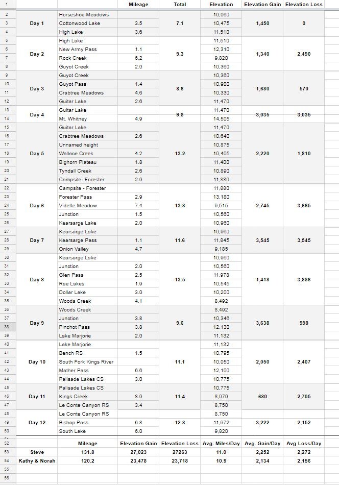
:: Days 1 and 2: Horseshoe Meadows to Guyot Creek 
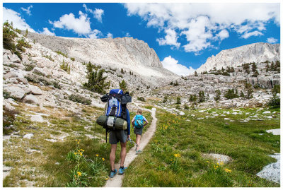
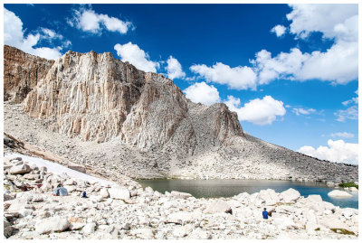
::
Day 3: Guyot Creek to Guitar Lake
:: Day 3: Guyot Creek to Guitar Lake 
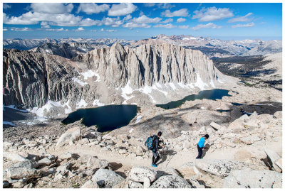
::
Day 4: Mt. Whitney
:: Day 4: Mt. Whitney 
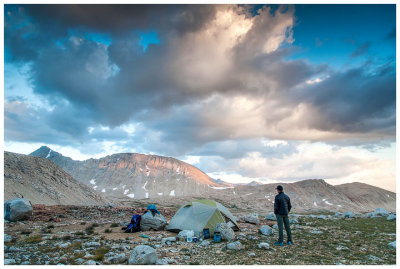
::
Day 5: Guitar Lake to Forester Pass Basin
:: Day 5: Guitar Lake to Forester Pass Basin 
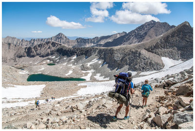
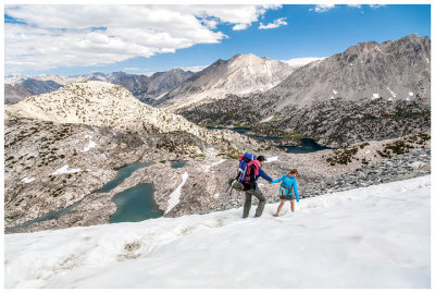
::
Days 6 and 7: Forester Pass Basin to Kearsarge Lakes (plus rest day)
:: Days 6 and 7: Forester Pass Basin to Kearsarge Lakes (plus rest day) ::
Day 8: Kearsarge Lake to Woods Creek
:: Day 8: Kearsarge Lake to Woods Creek 
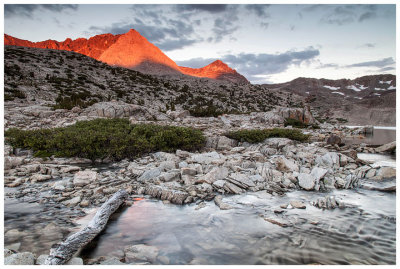
::
Days 9 and 10: Woods Creek to Palisade Lakes
:: Days 9 and 10: Woods Creek to Palisade Lakes ::
Days 11 and 12: Palisade Lakes to Bishop Pass
:: Days 11 and 12: Palisade Lakes to Bishop Pass 
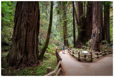
::
Alabama Hills, Mono Lake, and Muir Woods
:: Alabama Hills, Mono Lake, and Muir Woods ::
Favorites
:: Favorites ::