


|
|
|
|
|
|
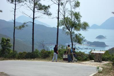
| Peter Chan | profile | all galleries >> Galleries >> MacLehose Trail Stages 1 and 2 (Updated Aug 2007) | tree view | thumbnails | slideshow |
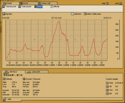 Trail profile of Stage 1 and 2 |
 |
 Fishing fun (釣魚樂) |
 |
 |
 |
 HK Scout Island Camp 2004 at Chong Hing Water Sports Centre 創興水上活動中心 |
 Chong Hing Water Sports Centre (創興水上活動中心) |
 DSCF0898.jpg |
 DSCF0902.jpg |
 DSCF0903.jpg |
 DSCF0904.jpg |
 DSCF0905.jpg |
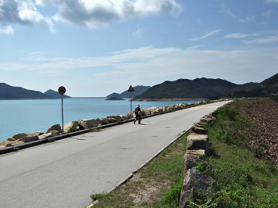
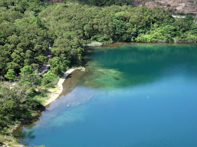
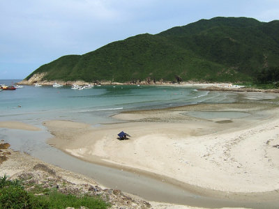
 Pak Lap Wan 白腊灣 |
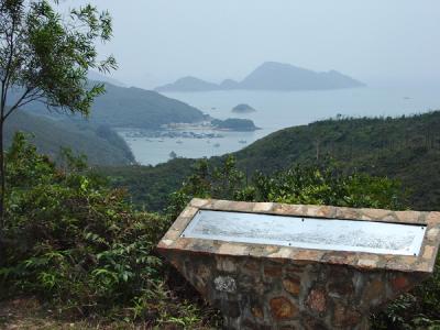 Pak Lap Wan 白腊灣 |
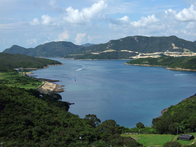
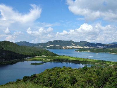
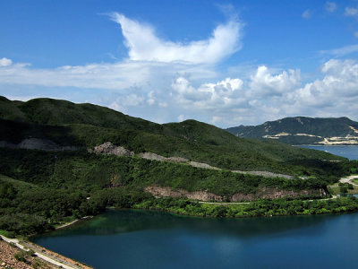
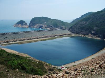
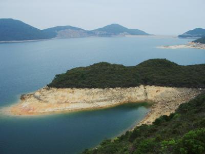 High Island Reservoir 萬宜水庫一景 |
 High Island Reservoir 萬宜水庫一景 |
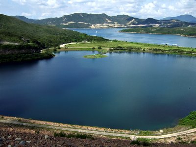
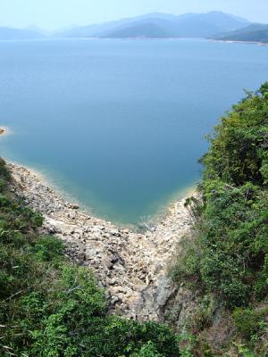
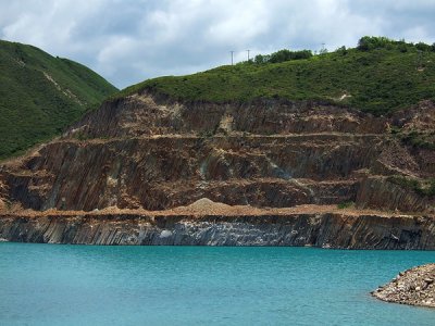
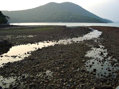
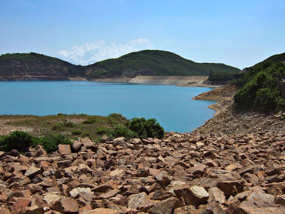 A bed of rocks near the Main Dam |
 |
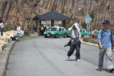
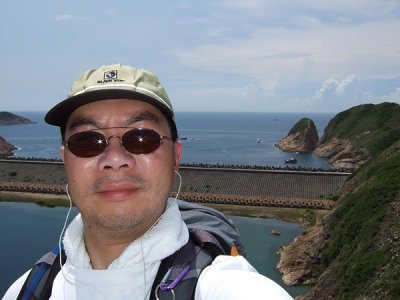 Don't tell me you know this terrible guy |
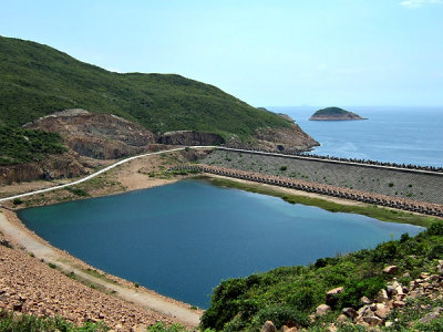
A large panorama of the scene at the Maim Dam |
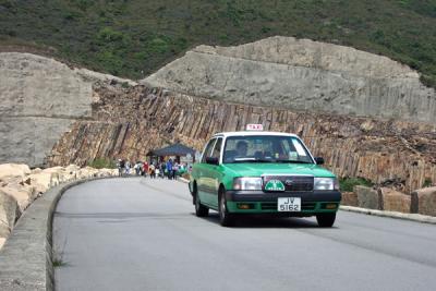 So much traffic at the Main Dam 交通繁忙的東大壩 |
 So much traffic at the Main Dam 交通 |
 Main Dam and Po Pin Chau 東壩及破邊洲 |
 DSCF0932.jpg |
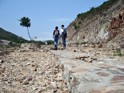 Newly constructed foot path after the Main Dam 東壩後新修築的小徑 |
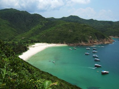
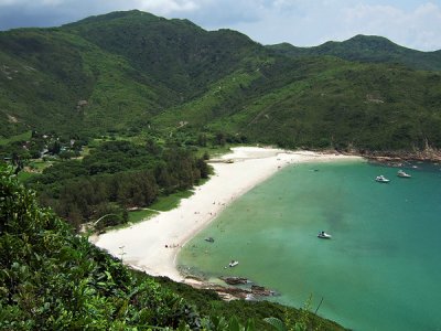
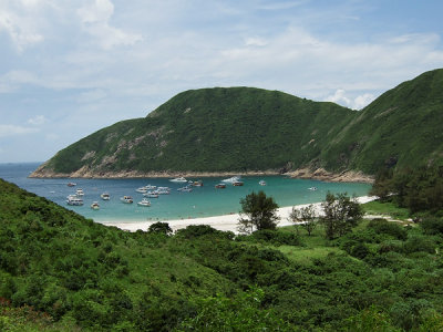
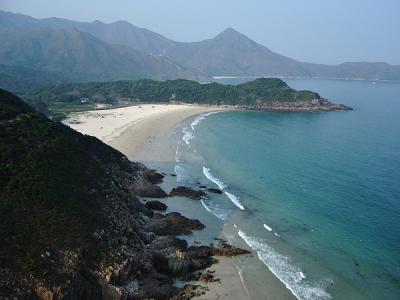
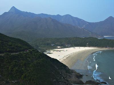
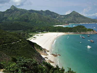
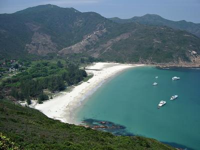 The Beautiful Long Ke Wan 美麗的浪茄灣 |
 DSCF0936.jpg |
 DSCF0937.jpg |
 DSCF0939.jpg |
 DSCF0940.jpg |
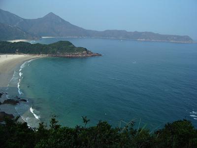
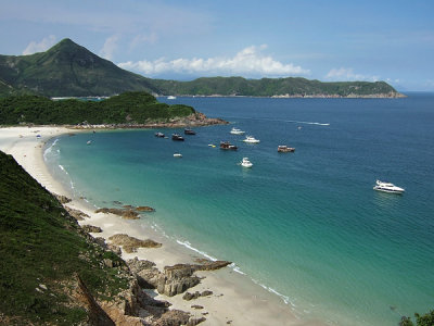
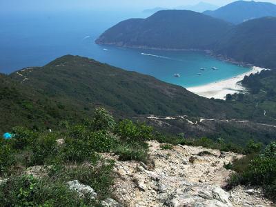 Looking back at Long Ke from Sai Wan Shan 西灣山上回望浪茄灣 |
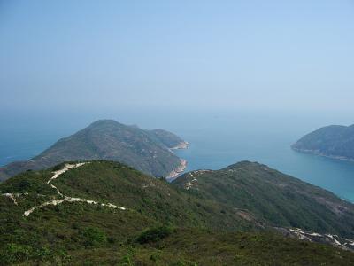 Tsang Pang Kok 罾棚角 |
 Looking back at Long Ke from Sai Wan Shan 西灣山上回望浪茄灣 |
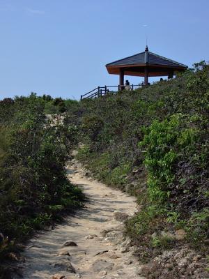 This bower on Sai Wan Shan was built after 2 men suffered heat stroke and died in 1999 西灣亭 |
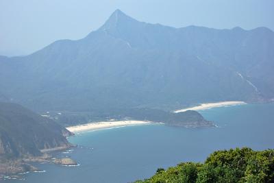 Sharp Peak, Ham Tin Wan (left), and Tai Wan (right) 蚺蛇尖, 鹹田灣 (左), 大灣 (右) |
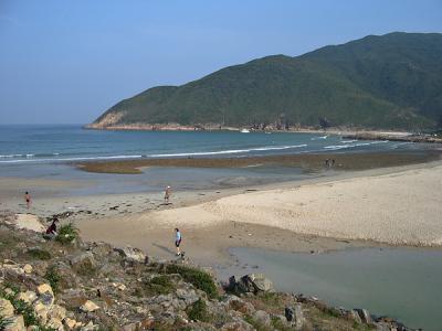
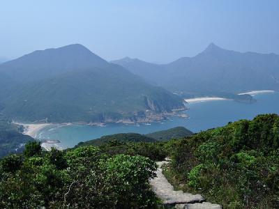 The beach on the left was Sai Wan 最左者為西灣 |
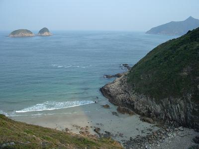
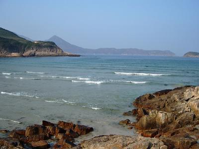 Looking at Cheung Tsui from Sai Wan 西灣遠眺長咀 |
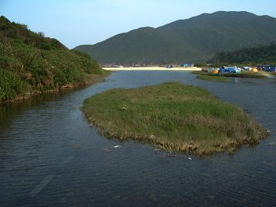
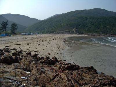 Sai Wan 西灣 |
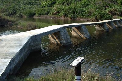 A bridge crossing Sheung Luk Stream near Sai Wan 橫跨雙鹿石澗的石橋 |
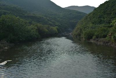 Sheung Luk Stream 雙鹿石澗 |
 Sai Wan from the Sheung Luk Stream Bridge 由雙鹿石澗望向西灣 |
 Sai Wan 西灣一景 |
 DSCF0945.jpg |
 Mong Yue Kok (middle) and Cheung Tsui (behind) 望魚角(中)及長咀(後) |
 Ham Tin Wan 鹹田灣 |
 Sharp Peak and Ham Tin Wan 鹹田灣及蚺蛇尖 |
 DSCF0946.jpg |
 DSCF0947.jpg |
 Tai Chau and Tsim Chan (far left) and Tai Yue Ngam Teng (far right) 後左: 大洲及尖洲; 後右: 睇魚岩頂 |
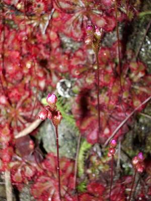 Drosera (a Carnivous Plant) near Ham Tin Wan 毛氈苔, 一種食蟲植物 (近鹹田灣) |
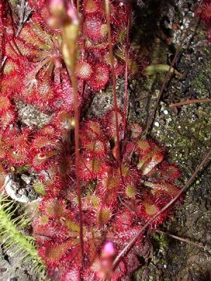 Drosera (a Carnivous Plant) near Ham Tin Wan 毛氈苔, 一種食蟲植物 (近鹹田灣) |
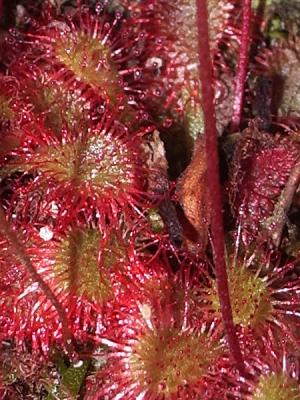 A close-up view of Drosera 毛氈苔上有黏液的觸鬚 |
 The quiet causeway at Chek Keng 赤徑一景 |
| comment | share |