


|
|
|
|
|
|
| John Scurlock | profile | all galleries >> Galleries >> The Pasayten Wilderness | tree view | thumbnails | slideshow | map |

I first travelled in the Pasayten as an impressionable 19-year old backpacker on the PCT
in August of 1973. I recall my thought then, that although I had already spent five weeks
alone in the wild areas of the Cascades farther south, I was about to enter
true wilderness - silent, vast, and mysterious. Over the years I have visited many
of the Pasayten's most remote areas; yet to this day I regard the Pasayten
with that same feeling. I could not have imagined that I would be photographing it someday
during winter from the air, and so I consider myself most fortunate
to be able to share these images now with you.
John Scurlock
March 16, 2007
THE IMAGES PRESENTED HERE HAVE BEEN DOWN-SIZED FROM THE ORIGINAL DIGITAL FILES.
Full-resolution color prints are available by request.
____________________________________________________________________________________________________
All Images Copyright 2004/2007, John Scurlock, Photographer & Pilot.
| previous page | pages 1 2 3 4 5 6 7 8 ALL | next page |
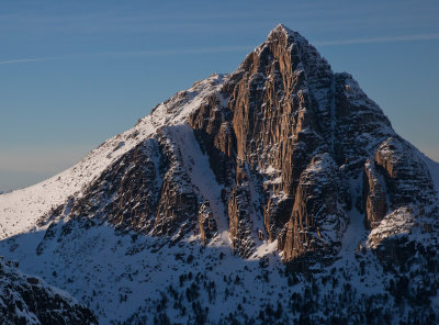
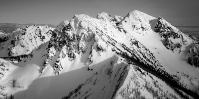
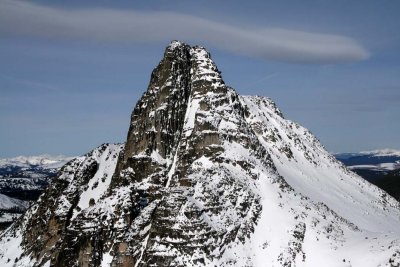 Cathedral, Upper E Face & N Slopes (R) (Cathredal040308-_18.jpg) |
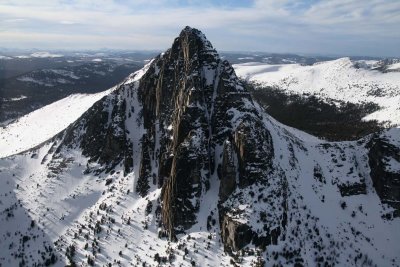 Cathedral, View NW (Cathedral030608-_031.jpg) |
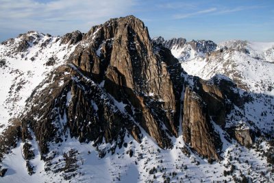 Cathedral, S Face (Cathedral030608-_051.jpg) |
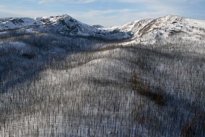 Sunny Pass, View NNW (HorseshoeBsn030608-_143.jpg) |
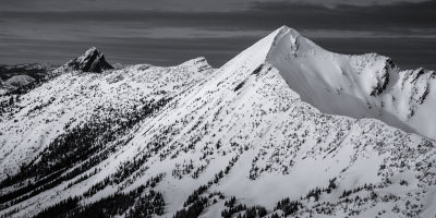
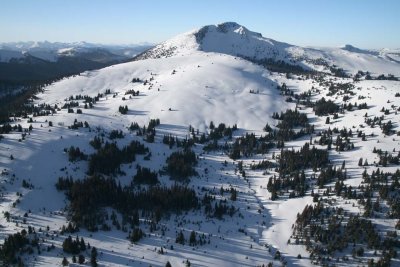 Sheep Mt, S/SE Slopes (SheepMt012208-_020.jpg) |
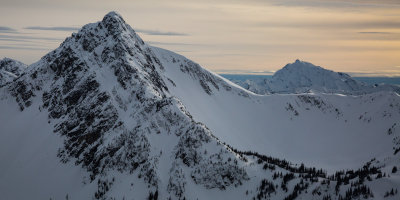
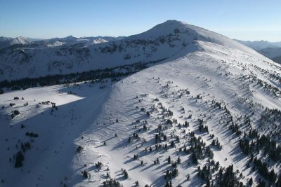 Sheep Mt, View S (SheepMt012208-_051.jpg) |
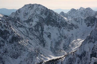
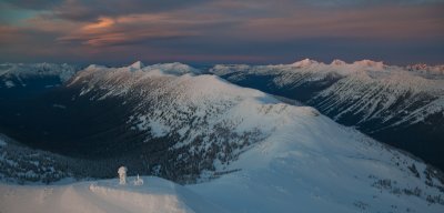
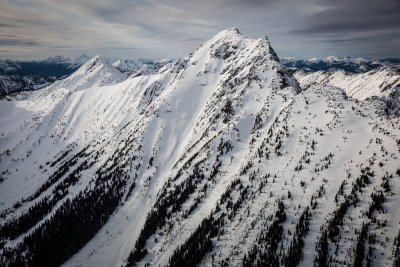
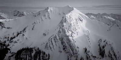
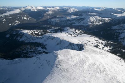 Sheep Mt & Pasayten Wilderness, View SE (SheepMt012208-_223.jpg) |
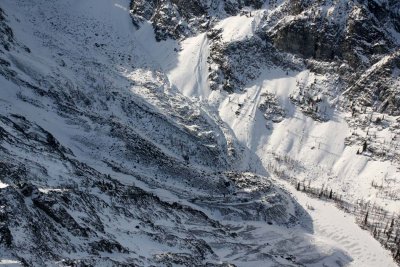
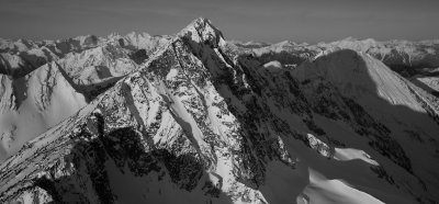
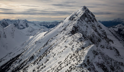
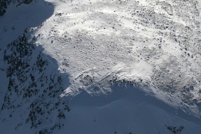 Sheep Mt, Summit Detail (SheepMt012208-_252.jpg) |
 Cathedral, South Face (Cathedral010311-038-1.jpg) |
 Big Craggy, W Face (BCraggy112308-_44.jpg) |
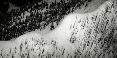
 No Dice Lake & Rock Glacier: Big Craggy, W Face (BCraggy112308-_52.jpg) |
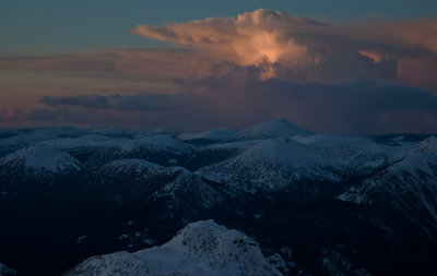
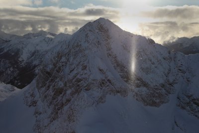 Sub-sun/Light Pillar, Osceola Peak (OsceolaCarLag120310-071adj.jpg) |
 Pasayten Sunset: Slate Peak & Gold Ridge, View North (Slate012511-25.jpg)* |
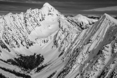
 Sheep Mountain & The North-Central Pasayten Wilderness (Sheep031911-05.jpg) |
 Cathedral, SE Face (Cathedral_020512_011-1.jpg) |
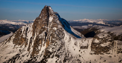
 Castle Peak From The East (Castle_020512_032-5.jpg) |
 Winthrop Mountain From The South (WinthropMt_032616_021-1.jpg) |
 Three Fools, Looking Southwest (ThreeFools_032616_001-2.jpg) |
 Castle Peak From The Southeast (Castle_032616_049-1.jpg) |
 Castle Peak, Looking To The Northwest (Castle_032616_063-2.jpg) |
 Powder Mountain's West/Northwest Face (PowderMountain_032616_006-3.jpg) |
 Fire To A Ridge, West Of Powder Mountain (PowderMountainFire_032616_012-4.jpg) |
 Castle Peak From The West (Castle_032616_011-1.jpg) |
 Blizzard Peak From The North (BlizzardPeak_032616_003-3.jpg) |
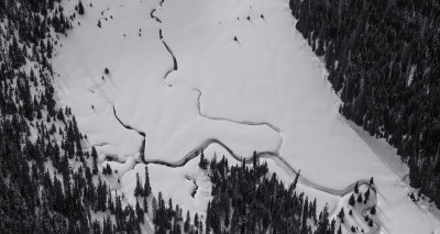 Meadow At Frosty Lake (FrostyCreek_032616_004-2.jpg) |
| previous page | pages 1 2 3 4 5 6 7 8 ALL | next page |