


|
|
|
|
|
|
| John Scurlock | profile | all galleries >> Coast Mountains: British Columbia >> Lillooet Icefield | tree view | thumbnails | slideshow | map |

_________________________________________
Gallery Satellite View: Lillooet Icefield
These images were obtained during flights conducted on January 15 & February 18, 2008.
Included are photographs of Mt. Elaho, the Manatee Range, Lillooet Icefield, and peaks
of the Monmouth Mountain/Tchaikazan Glacier region (SE of Chilko Lake).
Images of Toba Peak and Compton Mountain also appear in the Compton Neve gallery: LINK
All images in this gallery are geotagged.
Sincere Thanks to John Baldwin, whose assistance with the geography & nomenclature
of the Lillooet Icefield has been invaluable.
Reference: Exploring The Coast Mountains On Skis, 3rd ed., (John Baldwin, 2009)
________________________________________________________________________________
THE IMAGES PRESENTED HERE HAVE BEEN DOWN-SIZED FROM THE ORIGINAL DIGITAL FILES.
Full-resolution color prints are available by request.
____________________________________________________________________________________________________
All Images Copyright 2017, John Scurlock, Photographer & Pilot.
| previous page | pages 1 2 3 4 5 6 7 8 9 10 11 ALL | next page |
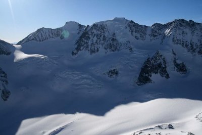
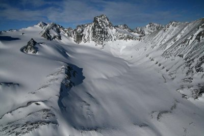 The Beast, SE Face (MonTchaikazan021808-_130.jpg) |
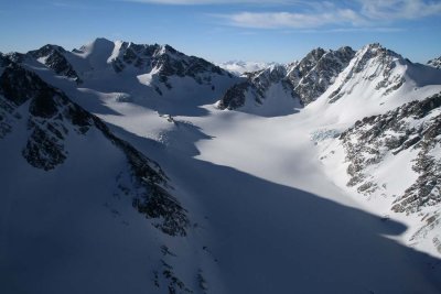
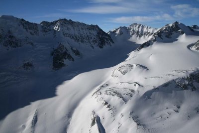 Winstone (L), Corner, & Metacarpus, View SSW (MonTchaikazan021808-_136.jpg) |
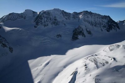 Winstone N Face (MonTchaikazan021808-_143.jpg) |
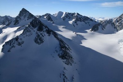
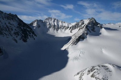 Corner Pk (L) & Metacarpus, View SW (MonTchaikazan021808-_161.jpg) |
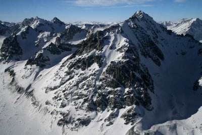
 Winstone, N Face (MonTchaikazan021808-_191.jpg) |
 The Beauty (L/Center) & Marmot Towers (R) (MonTchaikazan021808-_205.jpg) |
 The Beauty (Center) & The Beast (L) (MonTchaikazan021808-_213.jpg) |
 Rufous Mountain, View SW (MonTchaikazan021808-_221.jpg) |
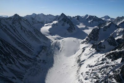 Discord Glacier, View S (MonTchaikazan021808-_227.jpg) |
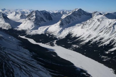 Upper Tchaikazan River, View SW (MonTchaikazan021808-_233.jpg) |
| previous page | pages 1 2 3 4 5 6 7 8 9 10 11 ALL | next page |