photo sharing and upload picture albums photo forums search pictures popular photos photography help login
Mark Dreiling | all galleries >> Trips >> Peru 2010 > Taquile Island (Map)
previous | next
27-FEB-2010

Taquile Island (Map)

view map

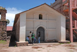
Two hour boat trip to this island.
We had to walk up a path to the town square which was about 450 feet above the level of Lake Titicaca.
The lake level is 12,500 feet so not an easy task for lowlanders.

Nikon D200
1/640s f/13.0 at 26.0mm iso800 full exif

other sizes: small medium large auto
comment | share