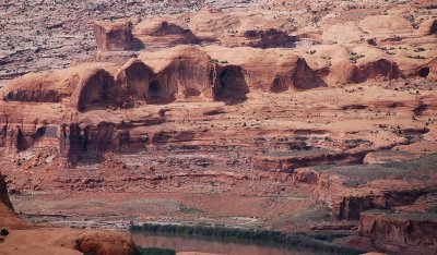
This northeasterly telephoto view from Amasa Back shows Pinto Arch at far right, casting a roundish shadow. The Colorado River is at bottom, flowing from right to left past the Gold Bar Recreation Area. The curving dark strip by the recreation area is Potash Road (SR 279). Just above the road is a light-colored area resembling an upside-down view of the head of a golf club---that's the parking lot for Corona Arch (the arch is out of view to the right). Farther above the road is a thin dark line sloping gently to the left. That is Union Pacific Railroad's Cane Creek Branch, a line serving the mine at Potash.
|