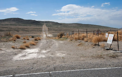
Looking west along the southern boundary of the Utah Test and Training Range where it is intersected by Puddle Valley Highway (the route to Lakeside). This wide swath is clearly visible from the air.
When playing with WikiMapia and Google Earth (same imagery in both) I noticed this boundary and was amazed that it was so clearly visible from high above. That made me wonder what it looked like from the ground, so it was fulfilling to see the boundary from my car.
Dan, this is a simple firebreak. I spent 5 years as an Explosive Ordnance Disposal technician, clearing this very range. With the abundance of fuel and low humidity, the military didn't want any of its wildfires ending up on public land. It doubles as an access road for maintenance vehicles to repair the fences.