


|
|
|
|
|
|
| Kenny Wilder | profile | all galleries >> Galleries >> Gulf Islands National Seashore | tree view | thumbnails | slideshow |
| previous page | pages 1 2 3 4 5 ALL | next page |
 _KWX7453.jpg |
 _KWX7454.jpg |
 _KWX7455.jpg |
 _KWX7459.jpg |
 _KWX7462.jpg |
 _KWX7467.jpg |
 _KWX7474.jpg |
 _KWX7478.jpg |
 _KWX7479.jpg |
 _KWX7480.jpg |
 _KWX7481.jpg |
 _KWX7482.jpg |
 _KWX7483.jpg |
 _KWX7499.jpg |
 _KWX7505.jpg |
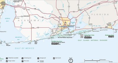 Map of Gulf Islands National Seashore.jpg |
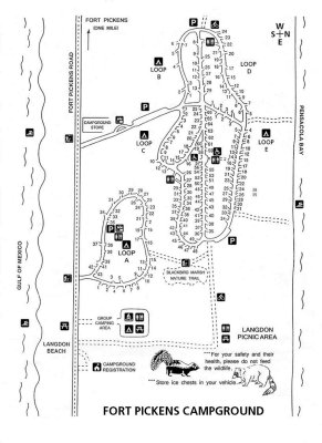 Map Fort Pickens Campground.JPG |
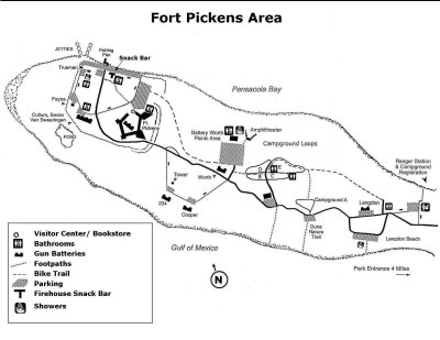 Map Fort Pickens.jpg |
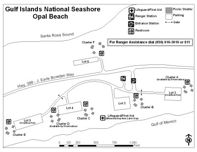 Map Opal Beach.jpg |
| previous page | pages 1 2 3 4 5 ALL | next page |
| comment | share |
| Guest | 04-Jun-2010 16:07 | |
| Joan | 26-Aug-2009 21:28 | |
| Milly | 22-Mar-2006 16:02 | |
| Guest | 03-Feb-2006 06:07 | |
| Jane | 06-Jan-2006 02:54 | |
| Martha | 29-Dec-2005 15:11 | |
| Guest | 28-Dec-2005 01:50 | |
| Sue Larson | 27-Dec-2005 16:58 | |
| Lisa | 24-Dec-2005 02:48 | |