photo sharing and upload picture albums photo forums search pictures popular photos photography help login
John Ewing | all galleries >> Galleries >> Once in a while > Paris-Strasbourg relief
previous | next

Paris-Strasbourg relief

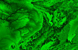
This is a rough plot of NASA SRTM (Shuttle Radar Topography Mission) altitude data for France, from west of Paris on the left to east of Strasbourg on the right. The river system that drains into the Seine is clearly visible: Paris is somewhere on the snaky black bits on the left. I made this plot to be certain I was interpreting the data properly, and the colour luminosity vs. altitude coding isn't perfect: generally, brighter=higher, but as altitude passes a certain value it recycles to black. I liked the pic, though, so here it is...


other sizes: small medium large original auto
comment | share
Guest 31-Aug-2009 17:36
Reminds meof our recent thunderstorms and tornadoes ...
Guest 31-Aug-2009 17:36
Reminds meof our recent thunderstorms and tornadoes ...
fotabug29-Aug-2009 16:25
Awesome. Made me think first of a leaf
Dirck Brinckerhoff29-Aug-2009 02:26
If you'd posted it without explanation, I might have guessed a cerebral scan.
Laura Milholland28-Aug-2009 05:12
This is amazing, John! At first I also thought I needed to grab the salad dressing. Very intricate and interesting.
Steve Thuman28-Aug-2009 03:35
Oh come on, this is an Ivy leaf, taken in Rockwell Super Vivid Super Saturation mode!
Paul Milholland28-Aug-2009 02:13
I thought I was looking at a head of a trendy new lettuc for chic restaurants. ;)
Ed Duverger27-Aug-2009 16:36
Very impressive ,it's even beautiful.Great on the wall of a modern office or art gallery.