


|
|
|
|
|
|
| Jim Larkey | profile | all galleries >> Galleries >> Canyon de Chelly, Chinle, AZ....June '05 | tree view | thumbnails | slideshow |
Beyond the Painted Desert, much of the far northeast of Arizona is barren and not particularly scenic, with wide empty valleys interspersed with low, scrub-covered mesas. Three of these, named the First, Second and Third, lie at the center of Hopi Indian territory but most of the northeast is Navajo land, including Chinle which is the largest town in the area and the gateway to Canyon de Chelly National Monument.
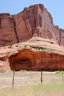
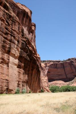
This comparatively little-known canyon is not as immediately spectacular as others in Arizona or Utah but it does have sheer walls rising up to 1000 feet with many scenic overlooks, several well-preserved Anasazi ruins and an insight into the present day life of the Navajo, who still inhabit and cultivate the valley floor.
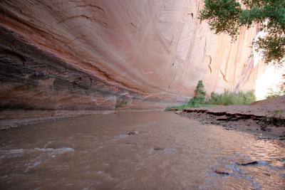
The Navajo: Just east of the town, the muddy, seasonal Chinle Wash enters the beginning of the canyon - here the walls are only a few metres high but rise sharply after a short distance so that there is only one possible entrance for vehicles, next to the river. A sandy track leads alongside the Wash to the scattered settlements and ancient ruins, but all visiting vehicles must be accompanied by a guide. The canyon floor remains green and fertile all year round; this, together with the protection offered by the rocky walls and the beauty of the landscape explain why the valley has been inhabited for so long - from primitive peoples 2000 years ago, through the Anasazi civilization of the twelfth century which occupied a large area of the Southwest before suddenly disappearing, to the Navajo who have lived here for the last 300 years. They still keep sheep and goats in the canyon, and plant crops.
Scenic Drives: The canyon actually comprises four main gorges, with many side ravines, branching eastwards from Chinle into the Defiance Plateau. Most of it may be reached only from above by rough, unpaved tracks - only the northernmost and southernmost edges are accessible from paved roads; the North Rim Drive (AZ 64) links Chinle with the north-south route AZ 12 and passes several overlooks. The South Rim Drive is not a through road but offers more dramatic vistas then the north road, ending at the most spectacular viewpoint, the overlook of Spider Rocks - twin 800 foot towers of rock isolated from the canyon walls and a site of special significance for the Navajo - according to legend, the Spider Woman lives on top and keeps the bones of her victims there. Beyond, the main canyon continues unseen for many miles.
White House Ruins: The Monument is administered as part of the National Park Service but since it lies on Navajo land, admission is free. However, unsupervised access is restricted to the rim overlooks and to a single trail into the canyon, leading to the White House Ruins - for all other trips down or along the canyon, a Navajo escort is required. These ruins date from about 1200 and are some of the oldest in the canyon. The trailhead is seven miles along the south rim drive; the one mile trail is rocky and steep in places but well-maintained and not too difficult - it takes between 25 and 50 minutes to get down, depending on your fitness. There are a couple of short tunnels, plenty of cacti and lizards, and the track passes a farm and an orchard before crossing the stream to the Ruins. Near the stream, just before the second tunnel, there is an interesting short-cut down a narrow gully, using old foot-holes carved in the sandstone walls.
(The American Southwest)
| previous page | pages 1 2 3 4 5 ALL | next page |
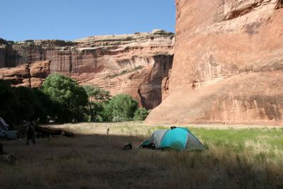 Sunday (1st) Nights Camp, Near Standing Rock |
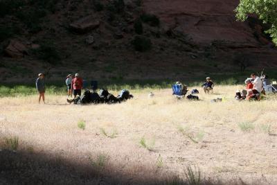 "Any Foxtails?"....Notice the Luxury of Chairs (The Joys of a "Traveling" Base-Camp) |
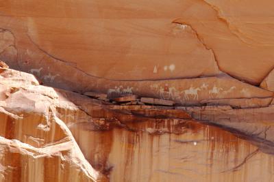
 Standing Cow Ruin (Note the Cow Rock Art) |
 Navajo Art Chronicles Narbona Expedition .....(Continued Below, Click on Pic) |
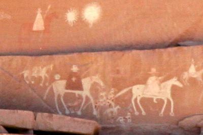 The 3-Foot Rider With Cape & Cross, Could Be Lt. Antonio Narbona |
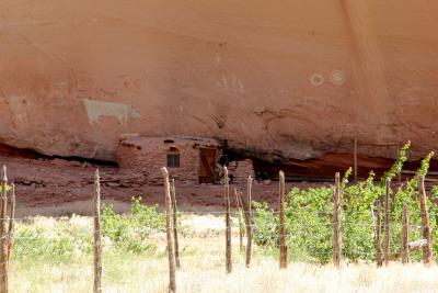
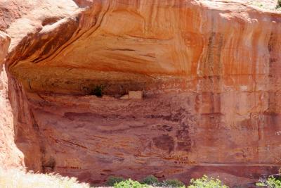 Ceremonial Cave Ruins |
 Ceremonial Cave Ruins |
 Foxtail in Black Rock Canyon |
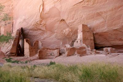 Antelope House Ruins |
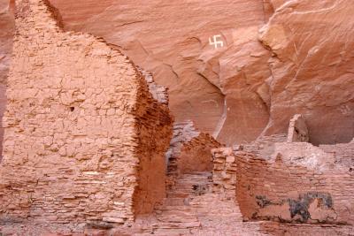 Antelope House Ruins |
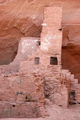 Highrise, Antelope House Ruins |
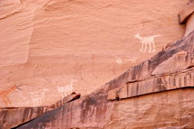
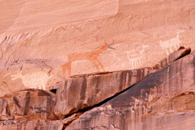 Life-Size Antelope Figure (Navajo) Whiteish Figure to Left is Great Pueblo (1100-1300 AD), Antelope House Ruins. |
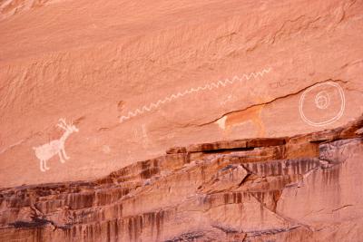
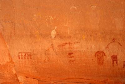
 Rock Art , Antelope House Ruins |
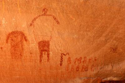
 Antelope Rock Art Attributed to Navajo Dibe Yazhi (Little Sheep), Antelope House Ruins |
 Antelope Were Abundant in the Plains SW of Canyon de Chelly, Until the Arrival of the Anglos, Antelope House Ruins |
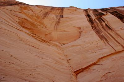 Streaks of Desert Varnish |
 Rock Art, Antelope House Ruins |
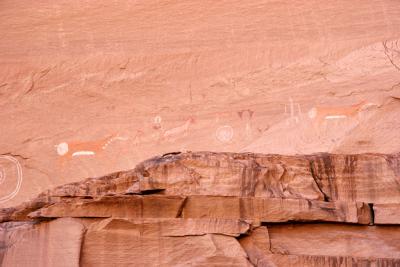
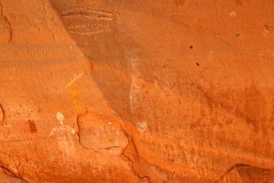
 Typical Basketmaker Art (Pre-450 AD), Bird-Headed Human Figure, Antelope House Ruins |
 Some More Rock Art |
 Shades of Paria Canyon |
| previous page | pages 1 2 3 4 5 ALL | next page |
| comment | share |
| Guest | 25-Jun-2005 19:46 | |