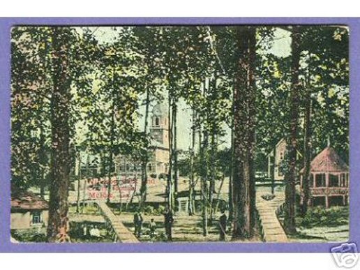
Jeff Anderson, I beg to differ with your assessment. Looking at this photo I see the front of the courthouse not the rear. In this photo of Windsor Park, (if enlarged) you can see the windows and the balcony that are on the second floor of the courthouse. I compared this photo and a photo of the courthouse dated from around the same time period, and think that Windsor Park was located across the street from the courthhouse, maybe in the general area of the old Gene theater.
Jeff Anderson
08-Nov-2011 02:55
I too believe Windsor Park was located in the area of where First Avenue intersects with Grant Street. A friend and I drove to this area this past weekend on November 6, 2011. As you drive along First Avenue to this area, there is a steady decrease in the elevation. Driving east down First Avenue you can see the rear corner of the courthouse behind you. It is the same view that is depicted in the picture. At the intersection of First Avenue and Grant you can no longer see the courthouse because of homes constructed over the years and trees. However, this area is the lowest point in elevation. The area around the intersection of First Avenue and Grant is the low point and would have likely to have had a stream or accumulation of water from time to time. The land from the courthouse sloped down to this area (the low point) and any watershed would have likely accumulated there. As you continue beyond First Avenue and Grant, the terrain begins to rise again for the next block.
Guest
11-Feb-2011 20:54
Thank you both Chuck and Sandy, I was in error. I had done additional research after seeing Chucks' comment last year, but failed to post my findings. It is indeed the old courthouse and the location from which it was taken is from the rear of the courthouse near the intersection of First Ave. and Grant Street.
Are you sure that isn't the First Baptist Church instead of the Old South Georgia Auditorium? The spire or steeple looks larger than the S. Ga. College building.
Ron & Gail Monroe
09-Jan-2010 12:24
Thanks, Julian and Danny for giving me this journey through memories of my youth.
The photo appears to be taken from 32deg 04' 04.95"N - 82deg 54' 14.84"W at an elevation of 220 feet, or the present location of the Glory Bound Church between 5th and 6th Ave. on College St.
I mention the elevation because it is the lowest point on College St. between the top of the hill at the Old South Georgia building(at268 feet) and US440,319,280(at 264 feet). All rain fall in this area would have to flowed through the park making the raised walkways shown in the photo necessary.
It appears that the photo is a black and white with color added. Is the photo by M.L. McGee and is the name of the park hidden by the colors? Does anyone(Danny) have his collection?
The gazabo, or a replica, has been moved or constructed on the grounds of the Presbyterian Church shown in the photo. And last, but certainly not least, the photo is centered on the "Old South Georgia College" building at the top of the hill.