photo sharing and upload picture albums photo forums search pictures popular photos photography help login
Ken Chambers ARPS | profile | all galleries >> Bures, Walberswick, Felixstowe, Landguard Point, Aldeburgh,Saxstead, Framlingham, Shotley, Southwold, Lavenham >> Bures St Marys Suffolk tree view | thumbnails | slideshow

Bures St Marys Suffolk

Bures St Mary is a civil parish in the Babergh district of Suffolk, England. In 2005 it had a population of 940.[1]
The parish covers the eastern part of the village of Bures, the western part being in the Bures Hamlet parish in Essex.
Bures is located on the border between South Suffolk and North Essex, in the heart of picturesque `Constable` country and in an Area of Outstanding Natural Beauty(AONB) The village we call Bures, is not a single entity but a union of the two parishes of Bures Hamlet (in Essex) and Bures St Mary (in Suffolk) Both parishes lie either side of the River Stour, which is the county boundary between Essex and Suffolk. To make life much easier for everyone, the village is called Bures. There cannot be many villages or towns in the UK which are divided down the centre by a county boundary ?
One of the oldest buildings is St Stephens Chapel which dates back to 1218 when it was dedicated by the Archbishop of Canterbury. It predates St Mary's Church in the village centre, by some 150 years. Even further back than that, history tells us on Christmas Day 855, Bishop Humbert of Elmham anointed a 14-year-old boy as King of the East Angles. The boy was Edmund, the chosen heir of King Offa, and his coronation was documented at `Burva`. The chronicler Galfridus de Fontibus also described the coronation as having taken place at "Bures", which is an ancient royal hill. It is the general belief that this was the lonely hilltop, where St Stephen's Chapel now stands.
In 1659 the village was also known as "Bewers" before it gained its modern title of Bures.
During the Victorian era, Bures was an Industrial village, completely self sufficient. Bures had its our own Tannery, Maltings, Brickworks, Abattoir, Gas Works, Electricity Generator and many other small industries. To keep the workers from suffering from de-hydration it had 8+ Public Houses !
Before the coming of the railway in 1849 the transportation of heavy goods manufactured in the village, such as bricks and malt were undertaken by barge (lighter) along the River Stour down to Mistley. This was immortalised by the paintings of John Constable with his portraits of Flatford Dry Dock and the White Horse etc. As time progressed, the railway had gained a foothold in speed and reliability, consequently the slow river traffic fell into decline and stopped in the early 1900s The rail line in its prime, connected Marks Tey to Sudbury and onward to Cambridge and Bury St Edmunds.
Unfortunately, even the railway wasn't safe, the transportation of goods collapsed as they were diverted away to road haulage and Dr Beechings axe fell during the 1960s. Fortunately, the section between Sudbury, Bures and Marks Tey was left intact, where today it links up with the main line inter-city services to London, Liverpool Street.
Like all villages, it has seen considerable change since those days. Today every plot of land is being developed to satisfy the incoming commuting public. One positive effect has seen the railway line rapidly grow in passenger numbers, which has resulted in millions being spent on upgrading the rail track as well as the introduction of modern rolling stock.
Bures can offer two Nature Reserves, Arger Fen a Site of Special Scientific Interest (SSSI) and the adjacent Spouses Vale owned by the Suffolk Wildlife Trust.
Back in the 1950s, Bures boasted something like 50 retailers within the two parishes, which included the pubs, a Co-op store, Barclays Bank, Blacksmiths and a multitude of small shops providing everything you could possibly require without leaving the village. Sadly, like many villages, it has seen a decline of those shops over the years and now only currently supports three retailers and a Post Office.
The centre of the village has many old historic buildings, some dating from the 16th and 17th century. Currently the parish has registered 75 listed buildings.
The population of Bures (2001 census) numbers around 1800, with 659 in Bures Hamlet and 728 in Bures St Mary.
In the Domesday records, the village is referred to as "Bura" or "Bure", it's documented having a church with 18 acres (73,000 m2) of free land. The name "Bures" could be derived from either an Old English word "bur", meaning a cottage or bower, or from a Celtic word meaning a "boundary", If the village was not named until after the Norman Conquest, (circa 1066) it could have been called after a French village of the same name, of which there are at least eight. (Bures en Bray, Bures sur Dives, Bures Les Monts, Bures (orne), Bures (Yvelines), Bures Sur Yvette, Bures, Les Bures.

Information Wikipedia
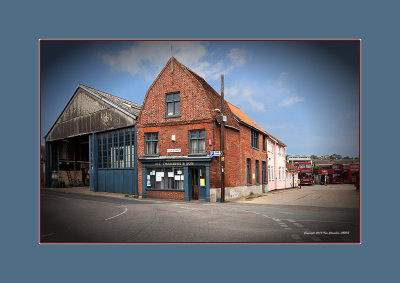
Chambers Bus Service, Bures Suffolk UK
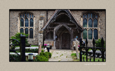
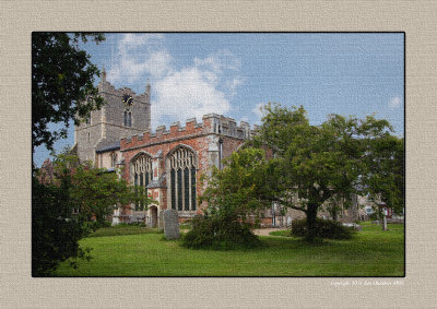
St Mary's Church
St Mary's Church
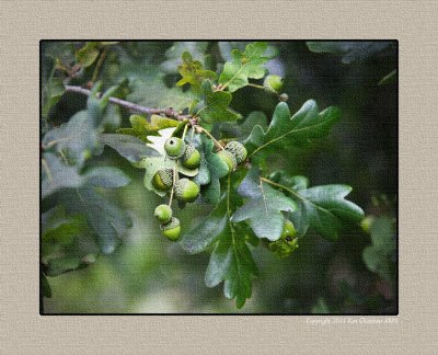
Acorns in the Church Yard
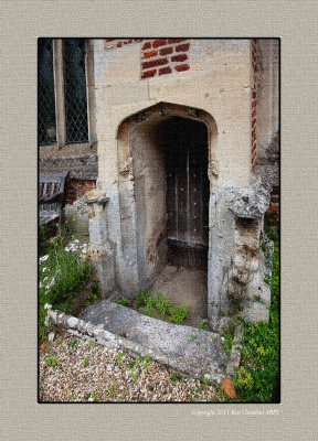
Church Side Door
Church Side Door
The St Mary's Vicarage Bures Suffolk.
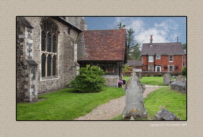
St Mary's Bures Suffolk
St Mary's Church Bures Suffolk
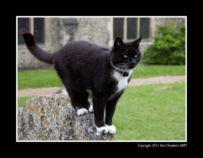
The Church Cat
The Church Cat