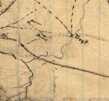
Use link to view this hand drawn map of the area during the Civil War. How many Boyt
places can you find? http://dc.lib.unc.edu/u?/ncmaps,1358
Note the directions on the maps as North goes to the right (left to right). Start at Goldsboro (bottom let of enlarged map) going North to Pikeville, Black Creek and Wilson. I have found 5 different Boyt/t locations on the map, generally West of a line between Pikeville and Black Creek. Some locations along the Neuse are in Johnston Co.
Repository Southern Historical Collection, Wilson Library, University of North
Carolina at Chapel Hill
Title Goldsboro-Wilson-Smithfield area
Date Published circa 1861-1865
Date Depicted circa 1861-1865
Creator - Individual Gilmer, Jeremy Francis, 1818-1883.