


|
|
|
|
|
|
| |
| 19-JUN-2009 | C.G. Anderson |
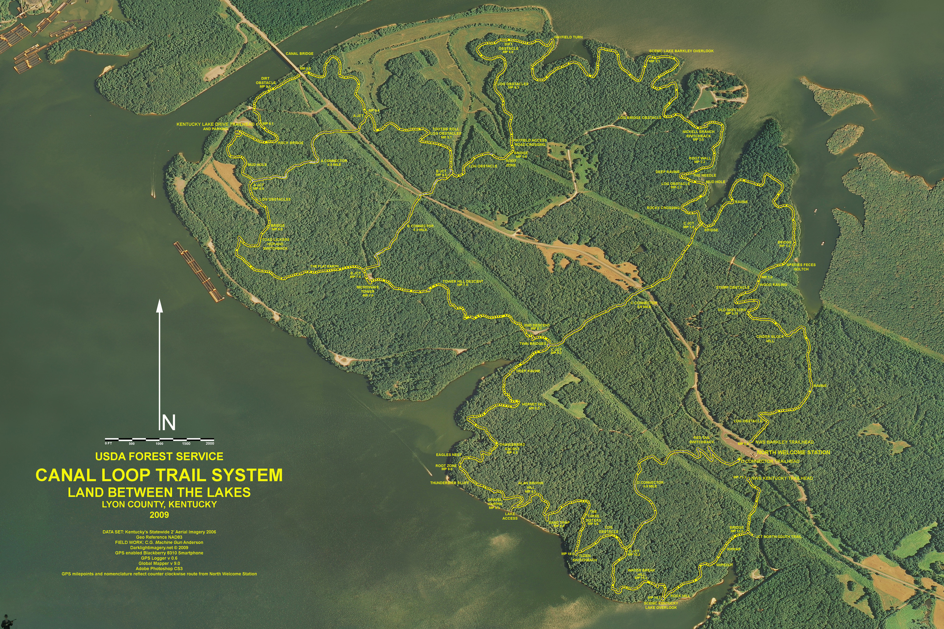
Composite map of the USDA Forest Service Land Between the Lakes Canal Loop Trail System, Lyon County, Kentucky. Blackberry 8310/GPSLogger overlay on Kentucky's 2006 2' Aerial Imagery database. Created in Global Mapper v9.03 and Adobe Photoshop CS3.
2004 C. G. Anderson
| comment | |