


|
|
|
|
|
|
| Kazuo Lim Khee Boon | profile | all galleries >> My Travel Album >> Indonesia >> Bali >> Bangli | tree view | thumbnails | slideshow |
Bangli
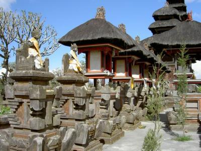
Bangli is a regency (kabupaten) of Bali, Indonesia. It has an area of 520.81 km˛ and population of 197,210 as of year 2004. Up till 1907, Bangli was one of the nine kingdoms of Bali. The capital has a famous Hindu temple, the Pura Kehen, which dates from the 11th century. Bangli also has one village, lies surround a hill, Demulih. The regency of Bangli covers two distinct geographical areas: the volcanic uplands of the Batur and Kintamani area, stretching down towards the sea near Tianyar and Tejakula and the upper part of the rice-growing area of southern Bali, overlooking Gianyar and Klungkung. Geographically, Bangli is home to the mountain lakes and water couches that make Bali so fertile. Numerous villages are scatted across a landscape of rice terraces, lush valley and forests. This mountainous region is a strikingly different site of Bali Aga traditional communities.
Gunung Batur |
| comment | share |