


|
|
|
|
|
|
| Brian McMorrow | profile | all galleries >> Asia >> China - 中国 >> Tibet - 西藏 (བོད་) >> Mt. Everest - Qomolangma >> New Tingri - Mt. Everest | tree view | thumbnails | slideshow |
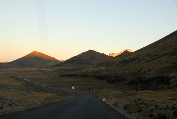 Early morning departure from New Tingri for Everest Base Camp |
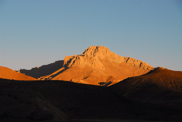
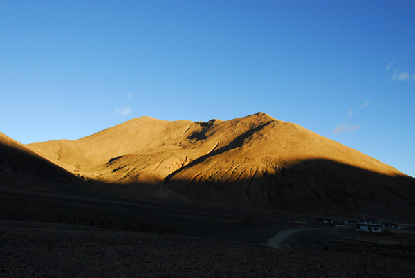
 Shegar, early in the morning |
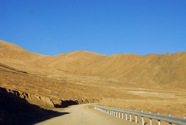
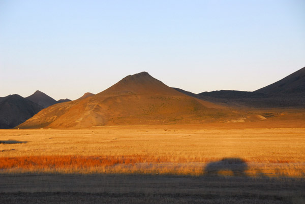 Shadow rolling along the Friendship Highway |
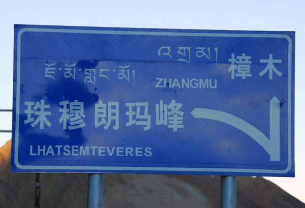 Mount Everest turnoff from the Friendship Highway at km 5145 |
 Morning light against the mountains of Pang-la Pass |
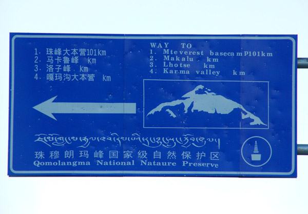 Qomolangma National Nature Preserve, Mount Everest Base Camp - 101 km |
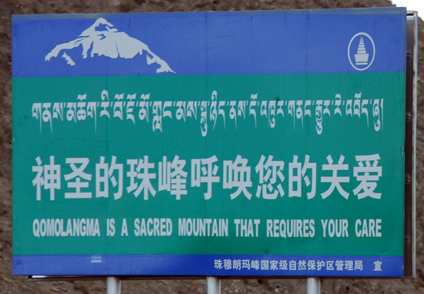 Qomolangma is a Sacred Mountain that requires your care |
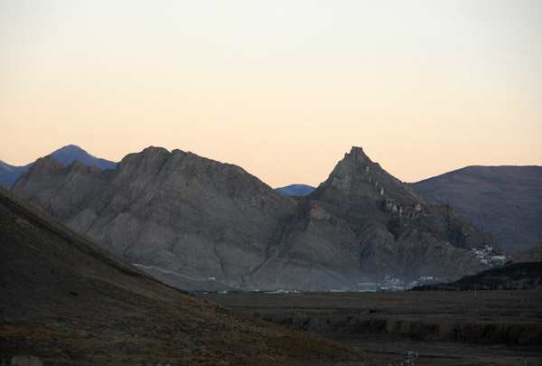
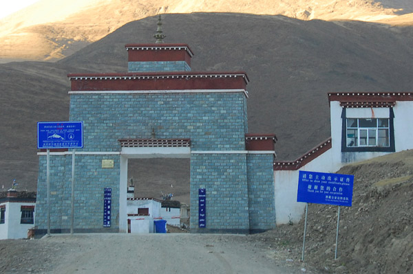 Mount Everest Checkpoint, Chay village (4300 m) |
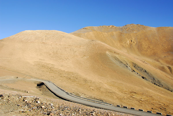
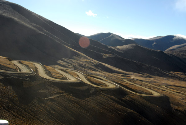
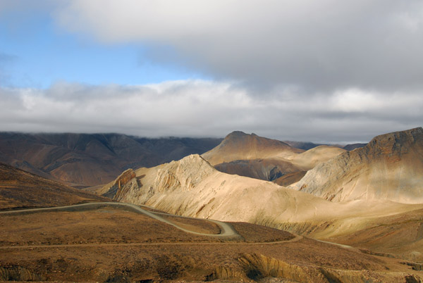
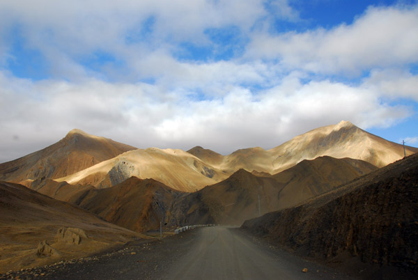
 The new road to Mount Everest over Pang-la Pass |
 Early morning drive up Pang-la Pass |
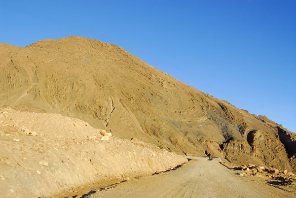 Climbing Pang-la Pass on the New Tingri-Everest Base Camp road |
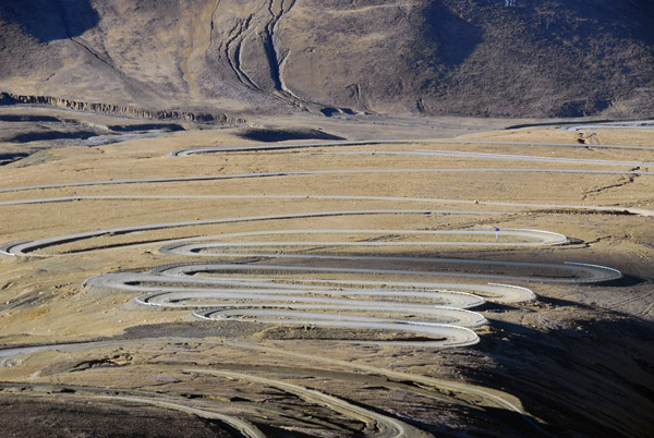
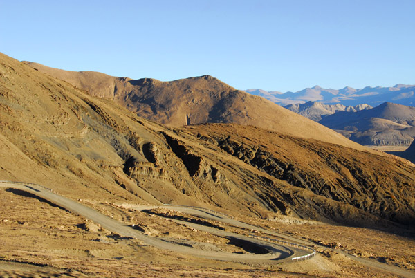 The road snaking up Pang-la Pass (5120m - 16,797 ft) |
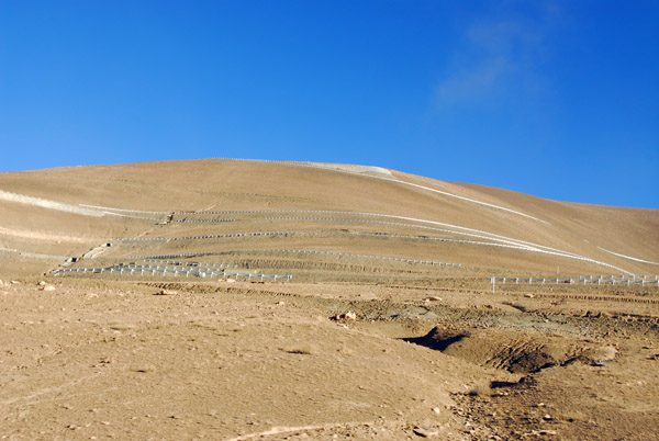
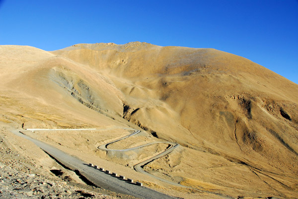 The road is unpaved but in good repair |
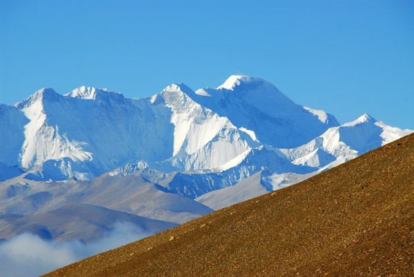
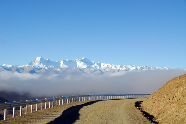
 Full range of the Great Himalaya 60 km away from the summit of Pang-la Pass |
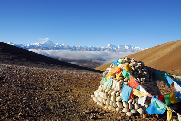
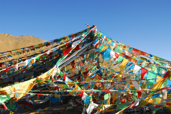 Prayer flags marking the summit of Pang-la Pass 5120m (16,797 ft) |
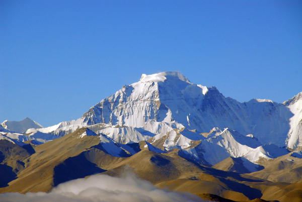
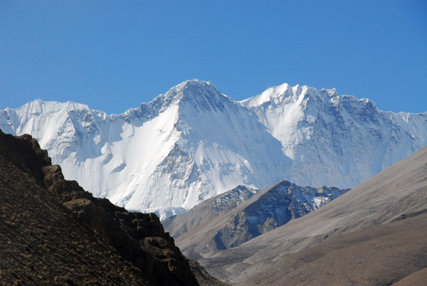
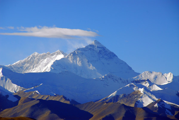 Mount Everest 8848m (29,028ft) and Lhotse 8516 metres (27,940 ft), 60 km from the summit of Pang-la Pass |
 Cho Oyu 8201m (26,906 ft) from Pang-la Pass |
 Gyachung Kang 7952m (26,089 ft) from Pang-la Pass |
 Chomo Lonzo 7780m and Makalu 8463m (27,765 ft) both on the left, with an unknown peak on the right, seen from Pang-la Pass |
 On the right, Cho Oyu 8201m and left, Gyachung Kang 7952m |
 Gyachung Kang 7952m from Pang-la Pass |
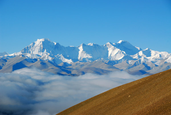
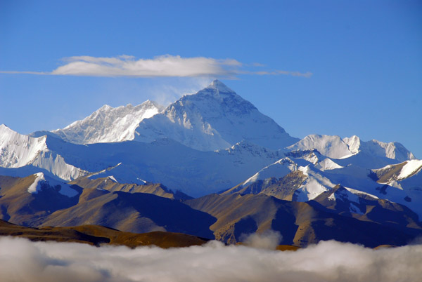 Mt Everest rises high above a low cloud deck obsuring the valley south of Pang-la Pass |
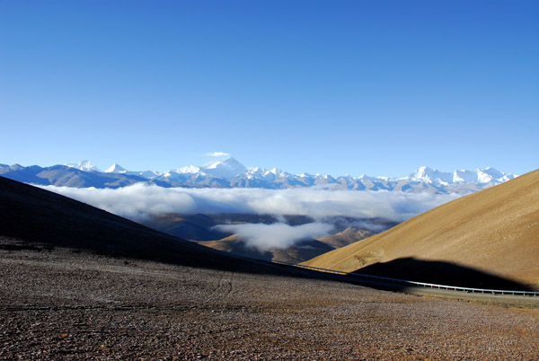
 Great Himalaya Range from Pang-la Pass |
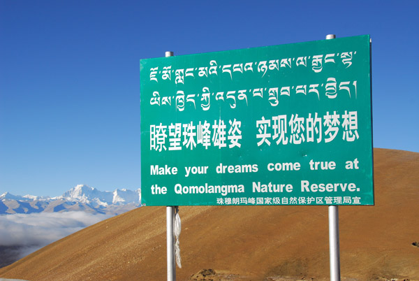 Make your dreams come true at the Qomolangma Nature Reserve |
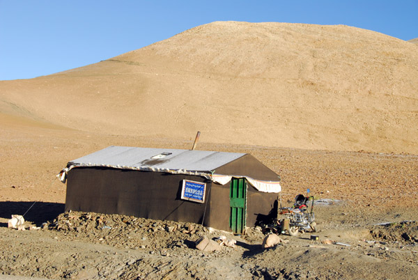 Souvenir shop, Pang-la Pass |
 The road down Pang-la Pass |
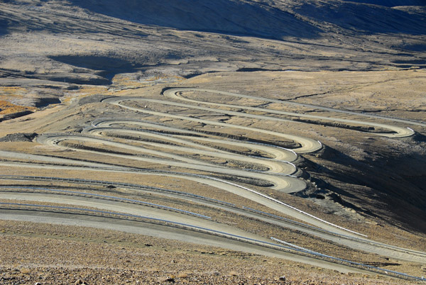 Dozens of switchbacks on the south side of Pang-la Pass |
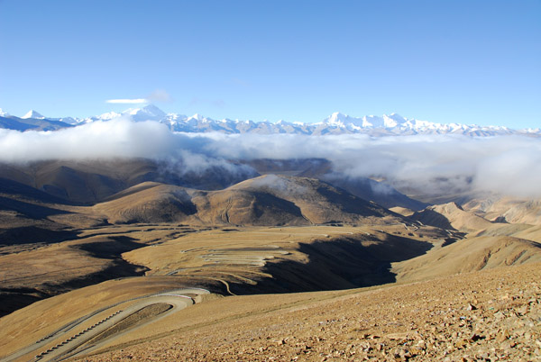 Impressive road down the south side of Pang-la Pass with the Great Himalaya Range above a cloud layer |
 I'm not sure when this road opened but it looks new |
 Road down Pang-la Pass with On the right, Cho Oyu 8201m and left, Gyachung Kang 7952m |
 This beats the road across the Andes from Mendoza to Chile for curves |
 Looking up the south side of Pang-la Pass |
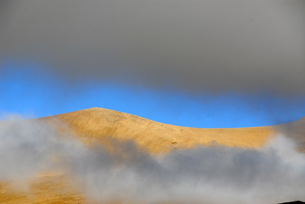 Slipping below some clouds |
 Descending Pang-la Pass - at least we know it's clear by Everest |
 Sunlight through a break in the clouds south of Pang-la Pass |
 The New Tingri - Rongphu road descending towards the Dzaka Valley |
 Ruins nearing the Dzaka Valley |
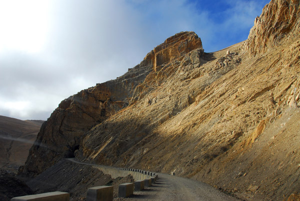
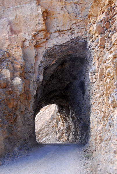
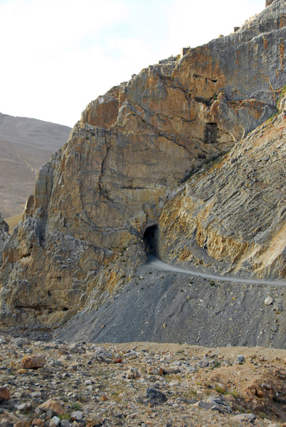 Narrow tunnel. New Tingri-EBC Road |
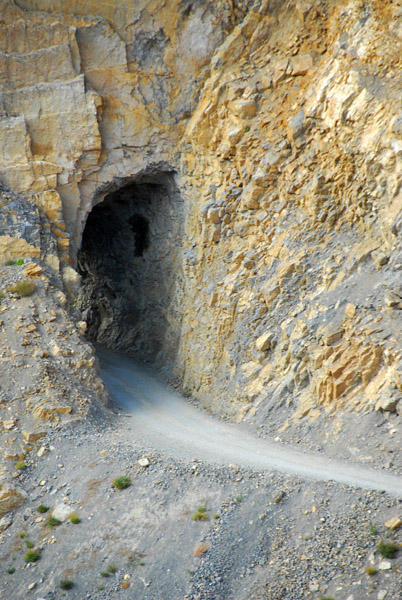 Road blasted through a narrow tunnel |
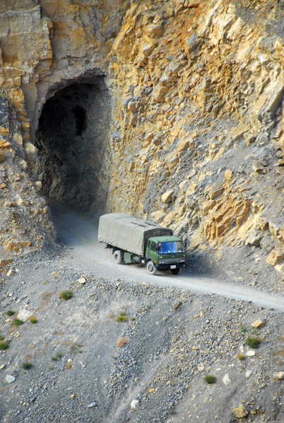 Good thing no one is coming the other way |
 The road approaching the tunnel just before Yungya Hamlet |
 Yungya Hamlet tunnel |
 The first small village south of Pang-la Pass, Yungya Hamlet |
 The road continues towards Everest Base Camp |
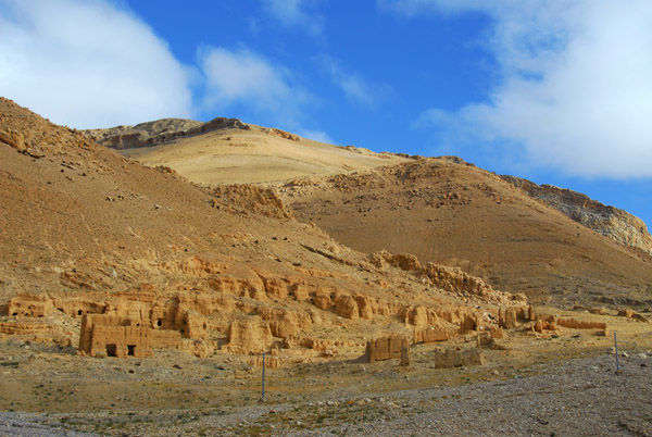
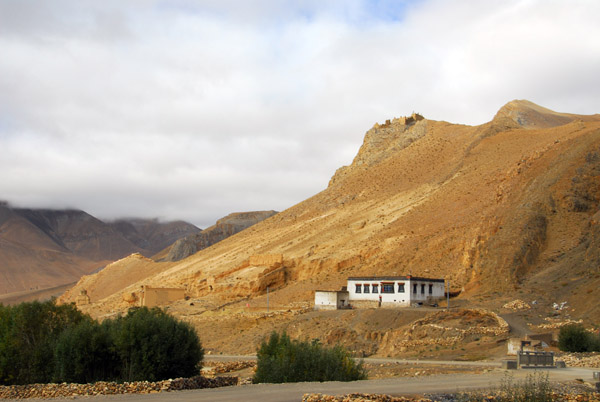 House among ruins, New Tingri to Everest Base Camp road |
 More ruins along the New Tingri - Rongphu road |
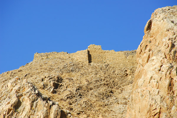
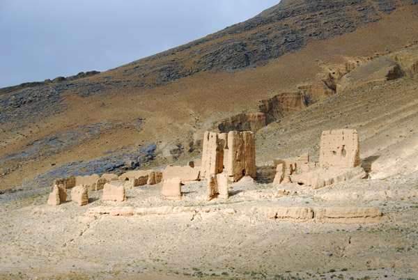
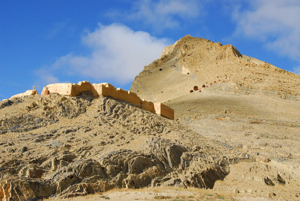
 Ruins of a fort or monastery, km 46 |
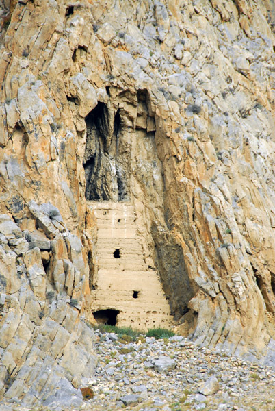 Cave dwelling |
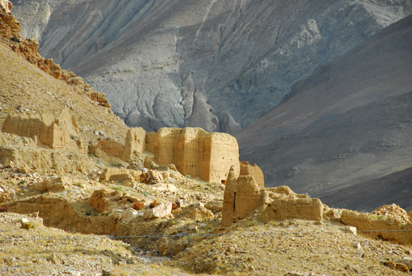 Ruins of a fort or monastery, km 46 |
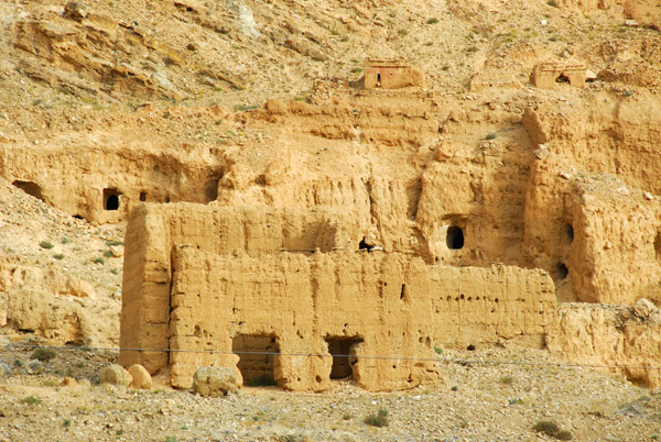 Many small caves punctuate the mountainside |
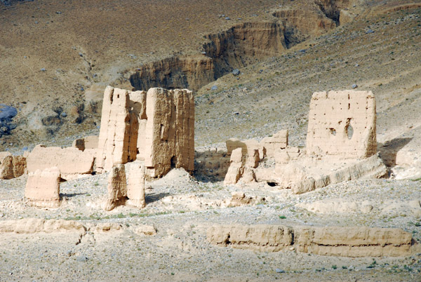
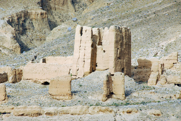
 The extensive ruins here look they they could have warranted further exploration |
 Ruins of a fort or monastery, km 46 |
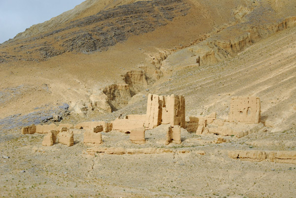 These ruins are at km 46 on the New Tingri-Everest Base Camp road |
 Ruins on the New Tingri - Everest road |
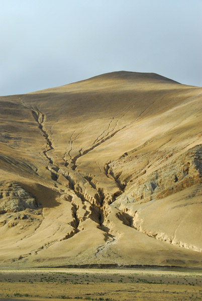 Erosion |
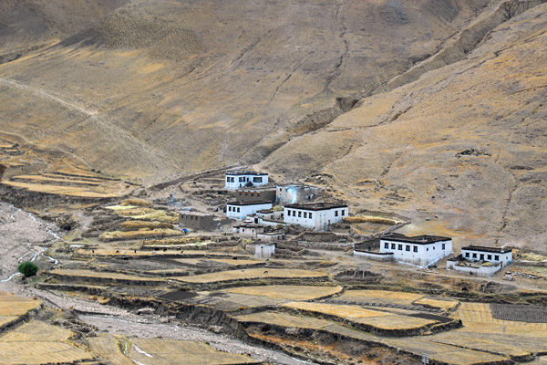
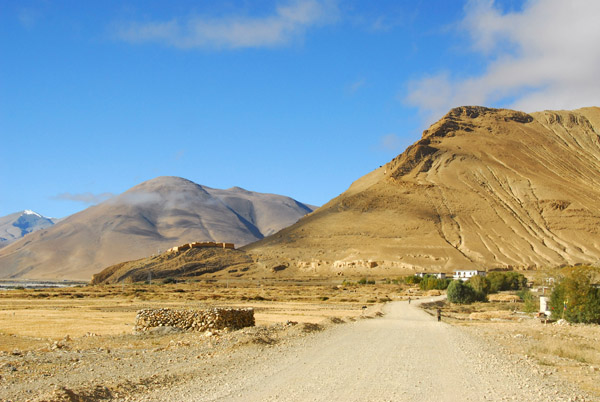
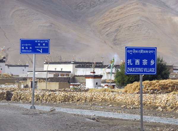 Zhaxizong Village, Garma Valley left, Mount Everest straight ahead |
 Zhaxizong Village (this may also be called Pedruk, Phadruk, Tashi Dzom or Peruche) |
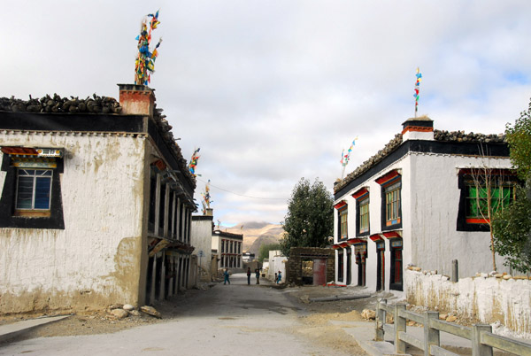 Zhaxizong Village |
 Leaving Zhaxizong Village for Everest Base Camp (Pedruk) |
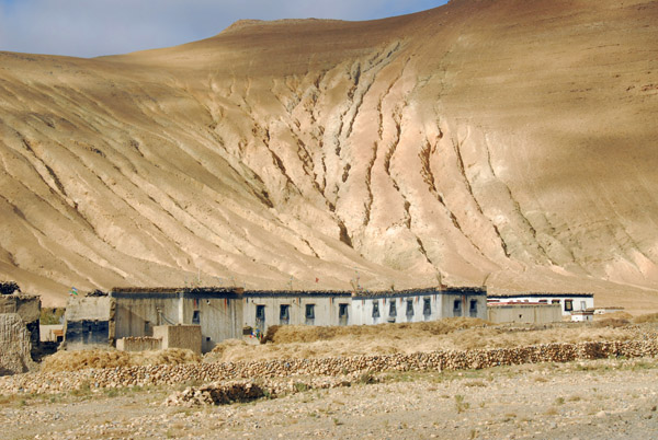 Small village at the base of an eroded hillside, Dzaka Valley |
 The Everest Base Camp road passing through the Dzaka Valley |
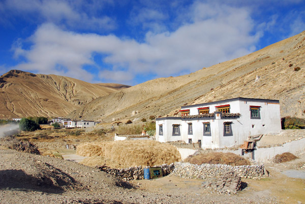 Tibetan village, Dzaka Valley |
 Tibetan village, Dzaka Valley |
 Tibetan village, Dzaka Valley |
 Tibetan village, Dzaka Valley |
 Tibetan village, Dzaka Valley |
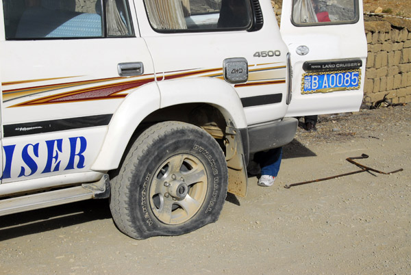 Flat Tire! To be honest, I'm amazed the ancient Land Cruiser made it this far |
 While the driver set about changing the tire, I starting walking down the road |
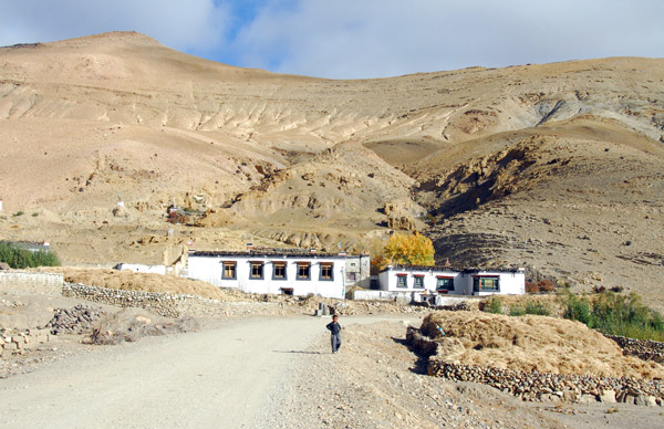 This is around km 57 on the New Tingri - Everest Base Camp road |
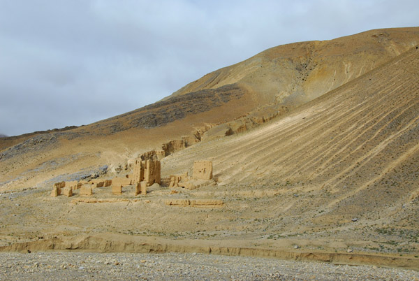
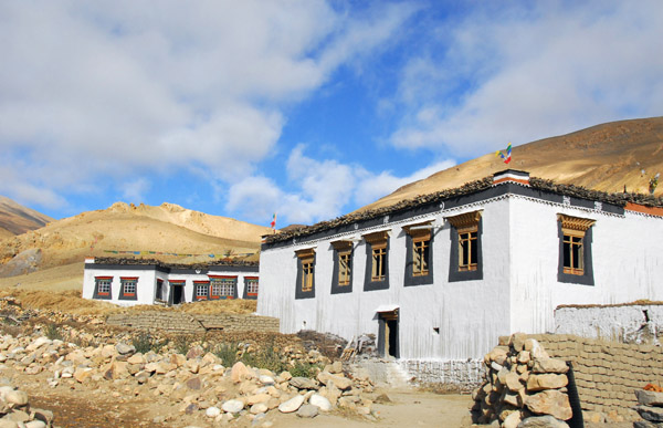
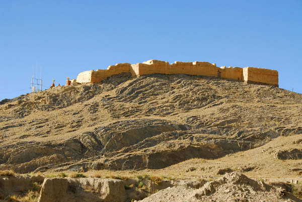 Ruins of a fort on a hill above the village where we got the flat tire |
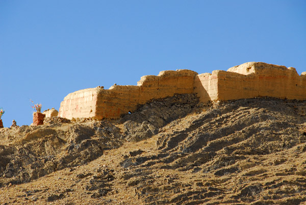 The fort is about 2 km prior to Pagsum Hamlet |
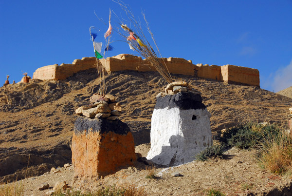 A pair of shrines with prayer flags roadside at the base of the fort |
 I decided it didn't look worth climbing so I set off down the road |
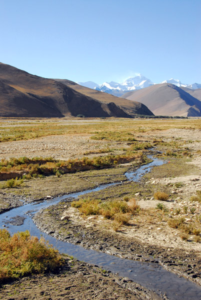
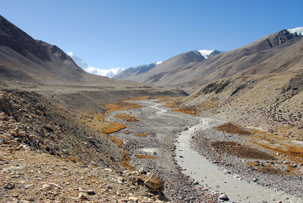
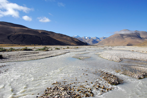 Dzaka Valley |
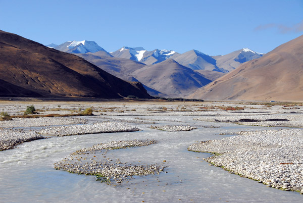 Dzaka Valley |
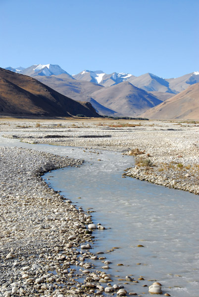 Dzaka Valley |
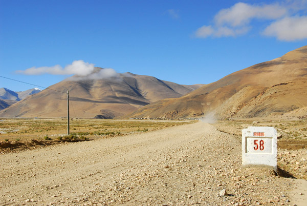 KM 58 of the New Tingri - Everest Base Camp Road |
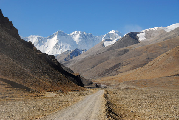
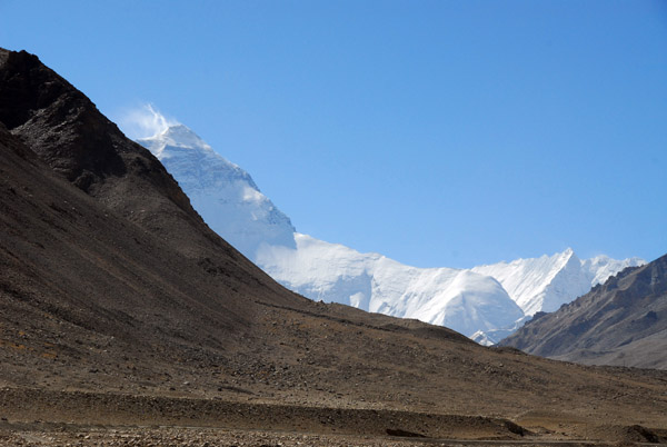
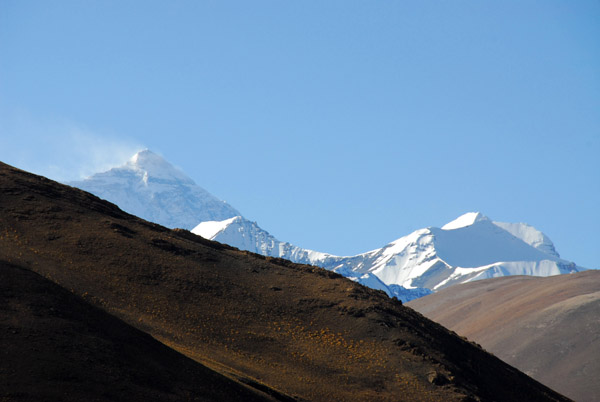 Mt Everest comes back into view for the first time since descending the Pang-la Pass |
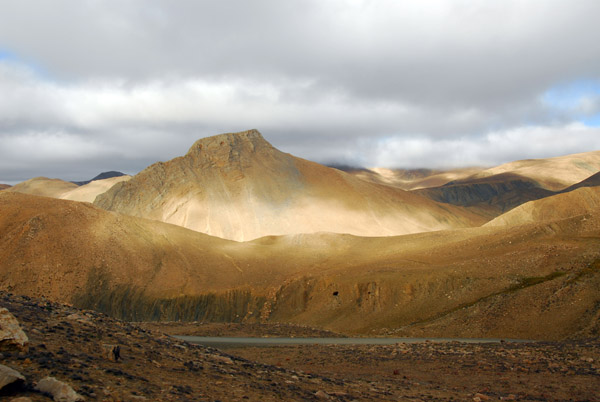
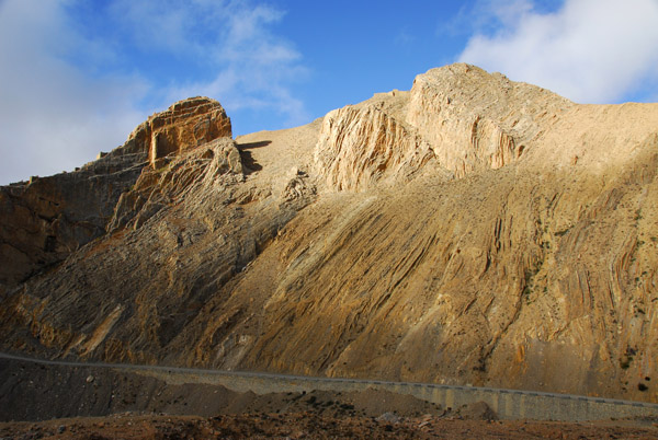
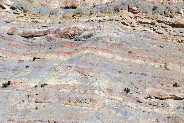 Interesing geology, Dzaka Valley |
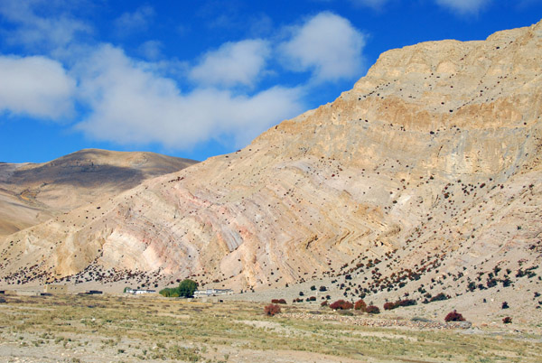 Folded mountain, Dzaka Valley near Pagsum |
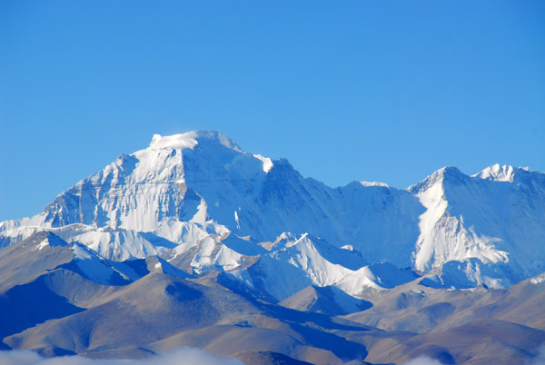
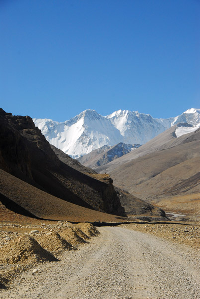
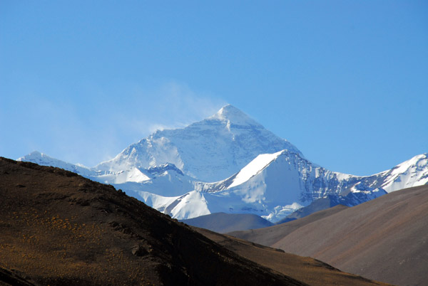 Mount Everest from the Dzaka Valley near Pagsum |
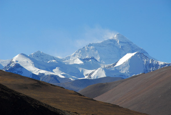 Mount Everest from the Dzaka Valley near Pagsum |
 Dzaka Valley near Pagsum |
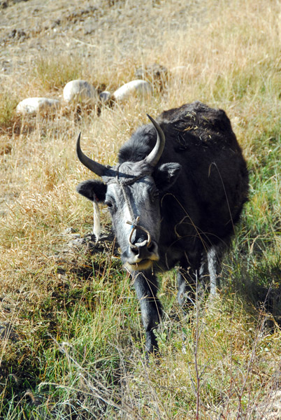 Small yak |
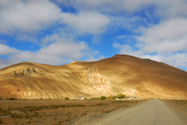
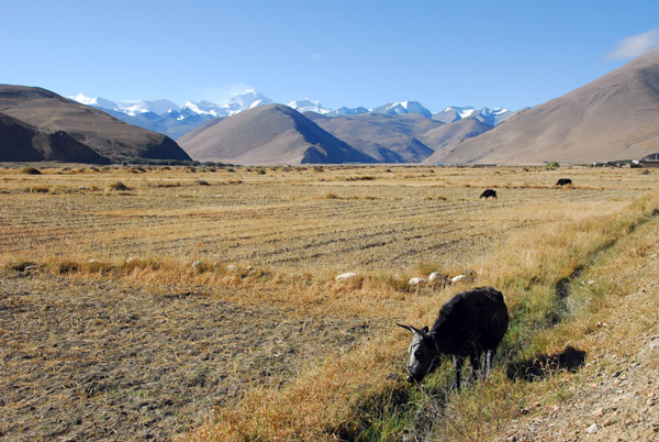 Dzaka Valley near Pagsum |
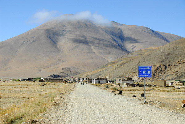 The next town, Pagsum Hamlet coming into view...good, I can use a Coke |
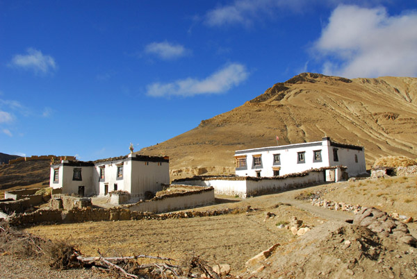
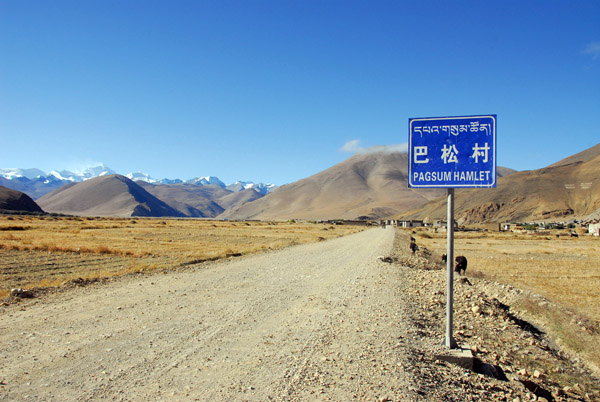 Pagsum Hamlet, Tibet |
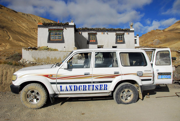
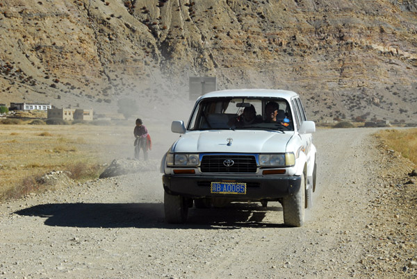 Tire fixed, here comes the Land Cruiser |
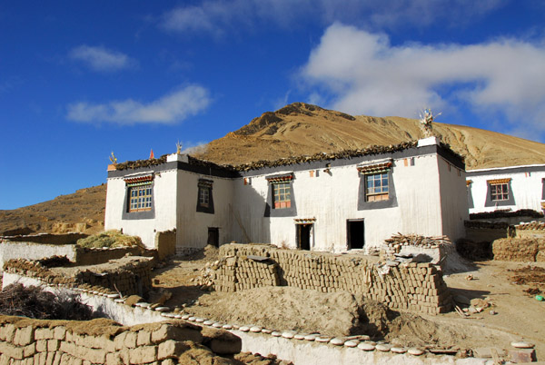
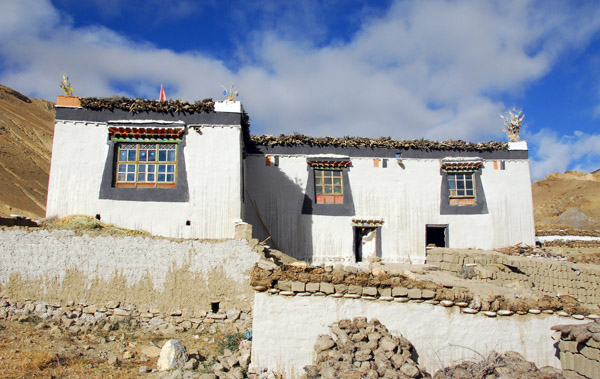
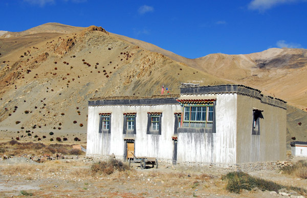 Tibetan house on the edge of Pagsum Hamlet |
 Tibetan house on the edge of Pagsum Hamlet |
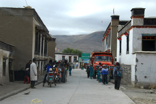
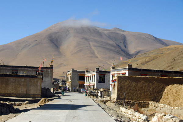 Main Street, Pagsum (Pasum) Hamlet |
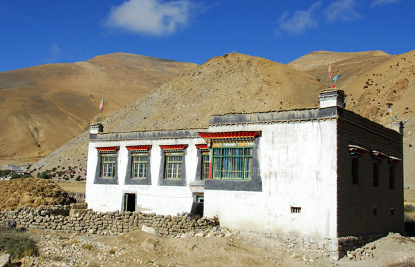
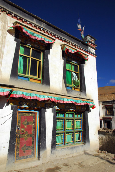
 Traditional Tibetan house, Pagsum Hamlet |
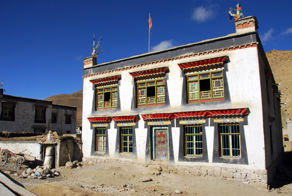
 Pagsum Hamlet |
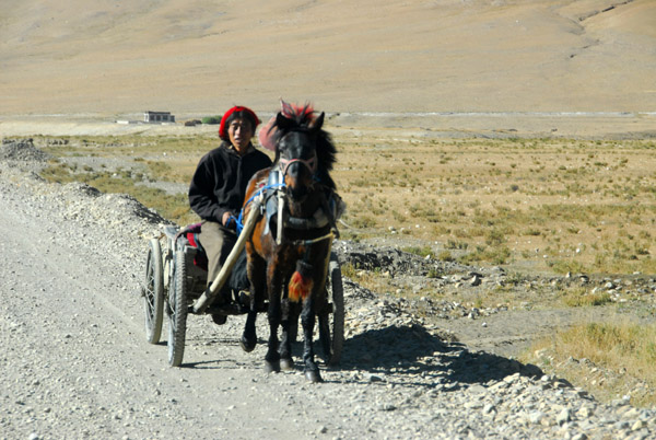 Tibetan man driving a horse cart |
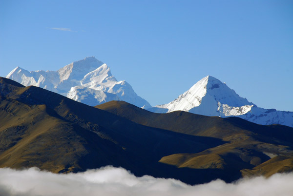
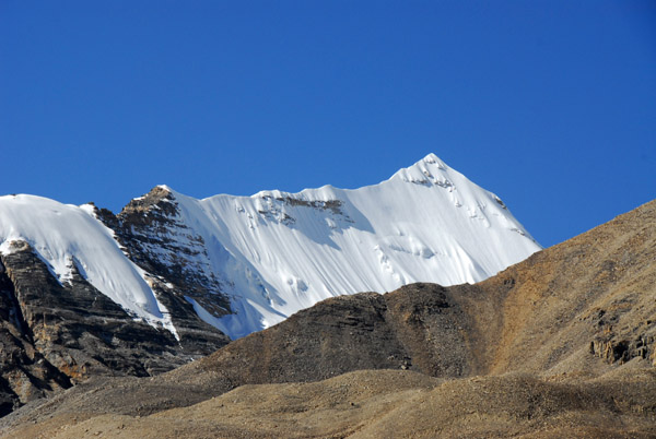
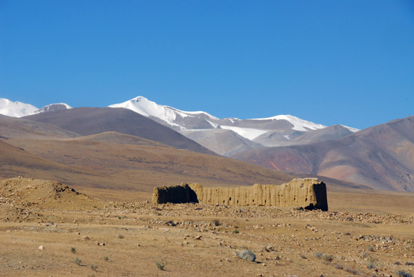 Ruins in front of snow capped mountains |
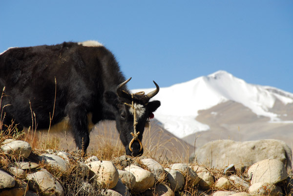
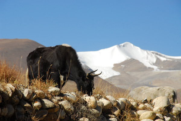 Yak with a snow capped mountain, km 71, just prior to Quzong Hamlet |
 Yak with a snow capped mountain and glacier |
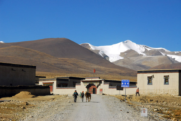 Quzong Hamlet, km 72 |
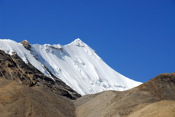
 Anywhere else, that snow capped peak would be famous...here's it's just a hill |
 Checkpoint at the junction of the New Tingri and Old Tingri roads |
 The final push to Everest Base Camp |
 North slope of the Himalaya between Cho Oyo and Gyachung Kang (N28.1067/E86.706) at around 25,200 ft |
 The road just before it turns slightly left to Everest |
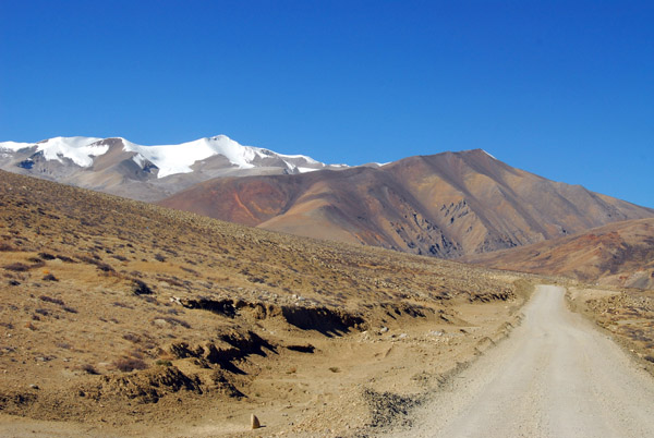
 The valley leading to Rongphu and Everest Base Camp |
 Mount Everest coming back into view as we near Rongphu |
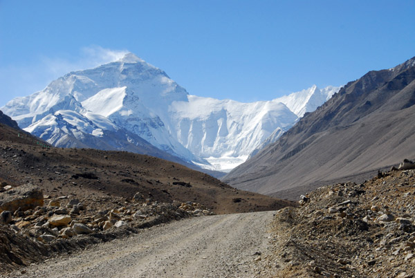 A beautiful clear day as we arrive at Mt Everest |
 Steep snowy ridge off to the right nearing Rongphu |
 Don't know what the name or elevation of this one is... |
| comment | share |