


|
|
|
|
|
|
| Suzanne Mathia | profile | all galleries >> Galleries >> Below the Rim | tree view | thumbnails | slideshow |
Made it to the depths of the canyon and back all in one piece with my sanity, feet and spirit intact.
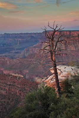
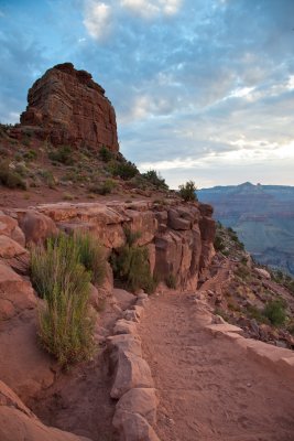
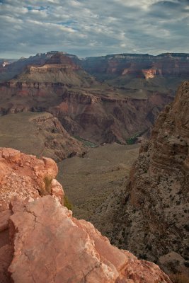
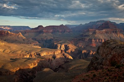
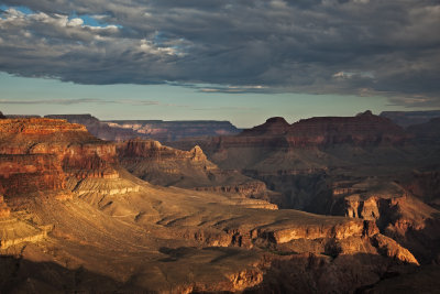
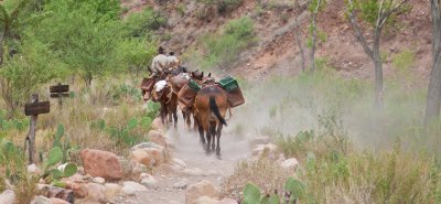
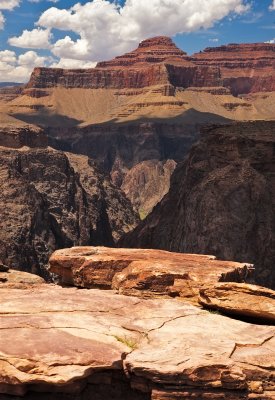
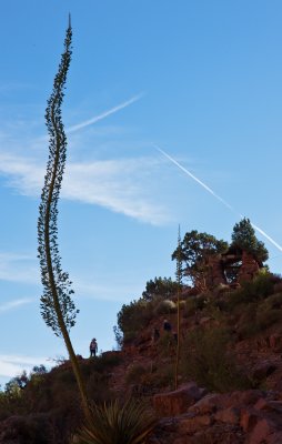
My decent on Sunday via the South Kaibab Trail started at 4:30 am. I was alone, heading over the edge, in the dark with nothing but my headlamp to guide the way. Fortunately theres enough light a good 30 minutes before dawn to be able to see pretty well. The grand canyon spread out before me, the air was warm but pleasant and as the sun rose over the towing buttes to the west I was overcome with the splendor of it all. The trail is well maintained and smooth. Its a 6.5 mile hike to the bridge that goes over the Colorado river. The trail winds down through the various layers of rock, past Ohh Ahh point, O'Niel Butte and zig zags down an area they call the red and whites. The switchbacks carve through the limestone and redwall alternately.
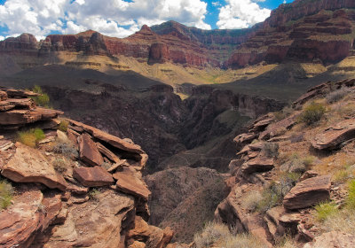
As you traverse the side of O'Neill Butte and circle to the backside, the trail levels off considerably, providing a brief break in the relentless spiral downward into the abyss of the canyon.
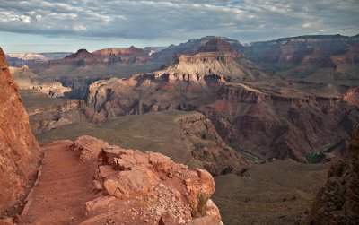
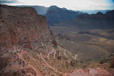
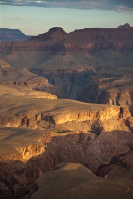
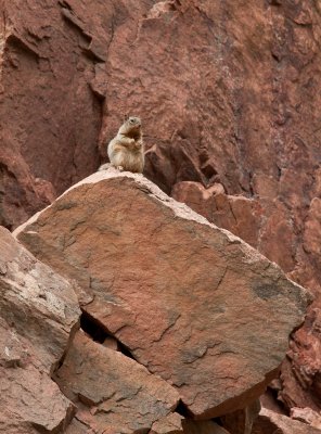
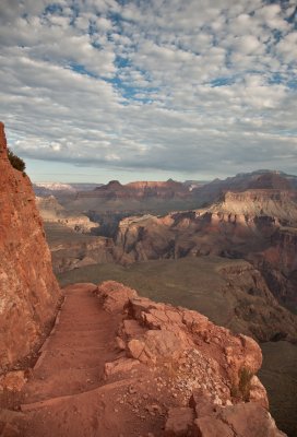
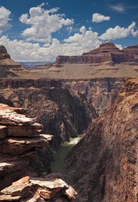
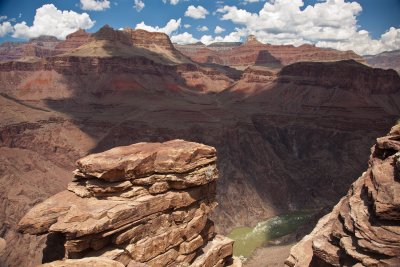
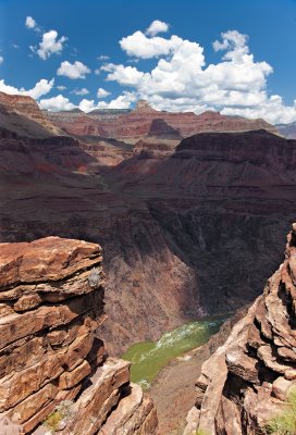
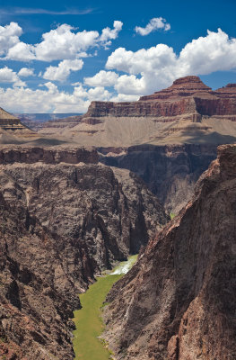
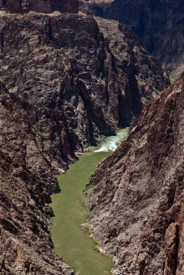
Just beyond Skeleton Point the fairly flat trail goes over what would otherwise be a cliff, but the trail makes almost a dozen switchbacks to descend this steep section. The view of these switchbacks is just one of the spectacular views on the South Kaibab. This is the first spot on the trail where you get a look (though just a glimpse) at the Colorado River. When you reach the bottom of the long switchbacks you've arrived on the Tonto Plateau and the trail flattens once again. This is the most desolate section of the entire trail. I am all alone..no others idiots out this time of year. You know what they say about mad dogs and englishmen!
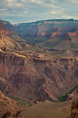
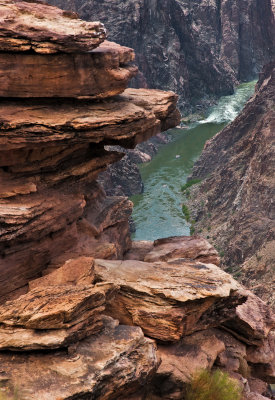
The Tonto Plateau ends at a point known as The Tipoff. There is a rest house and a hitching post, but no water. I have traveled 4.4 miles at this point, just over a 1/2 way down . What lies just ahead is the inner gorge of the canyon, also known as Granite Gorge. This is the most exposed and desolate part of the trail. It follows a ridgeline and there is no shade. The temperatures are now reaching about 110. There is no water on this trail either. Whatever you start with has to last you till you get to Phantom Ranch. On and on I go. Getting glimpses of the river and the ranch far below. I just plod on, one foot in front of the other, At this point you are praying for a little bit of shade, a cool breeze or at least some flat ground for a minute.
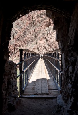
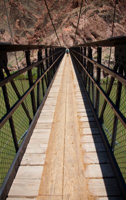
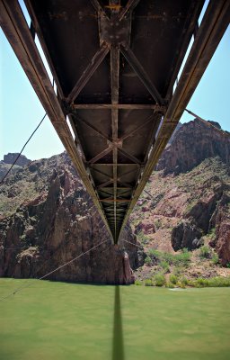
At last, I can hear the river and after 30 more switchbacks I finally enter the stone tunnel that leads out onto the Black suspension bridge that crosses the river. I have floated under this bridge on various river trips, now its my turn to wave at the rafters as they go by. I am hot, tired and sucking air our of my water container. The Phantom creek reaches the colorado river at this point and I dump my pack and lay in the cool running water, taking my hat and dumping more water over me. This has to be Nirvana..I am in heaven after walking through the gates of hell!
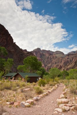
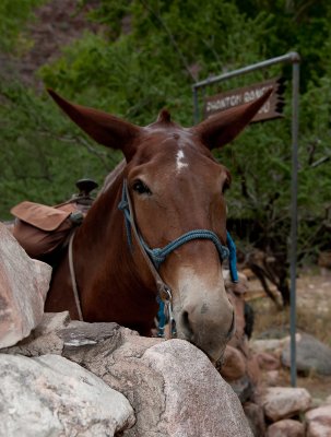
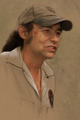
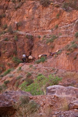
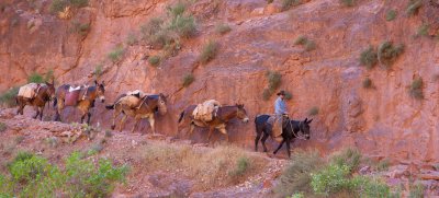
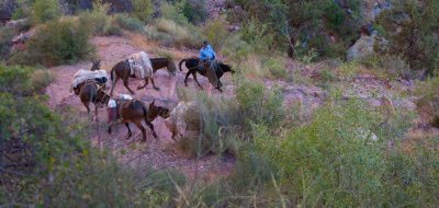
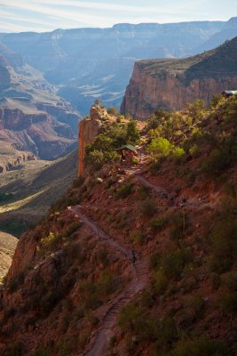
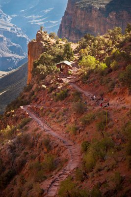
Another 1.9 miles up the canyon is my destination! Phantom Ranch is an oasis at the bottom of the canyon; a gorgeous setting against the cottonwood trees and other greenery that the nearby creek make possible. There are little stone cabins, a canteen with great family style meals and air conditioning! There are not too may people here this time of year..Cant imagine why! I spent 3 days photographing Sjors, the volunteer thats been at Phantom for 23 years. What a great guy, lots of stories and he knows everyone! I got to see the inner workings of the ranch and the ranger station and shadow Sjors around and he took care of everything and everyone down there.
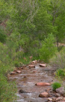
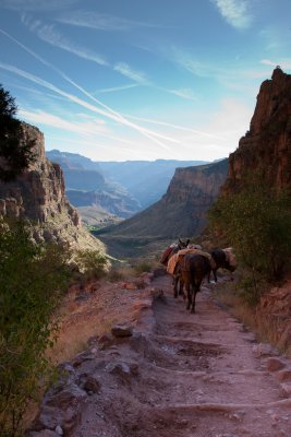
After 3 wonderful days, one of which was rainy and breezy and finally had to leave and make my way back up to the rim. It looks so very far away from there and at this point I cant imagine how I am going to do it. 4200 vertical feet over 9 miles of the Bright Angel Trail. I leave the ranch and head over to the Silver bridge to cross back over the river. The River Trail ends as it hits Pipe Creek. This is the real start of the Bright Angel Trail. The first chance for water is Indian Garden almost 4 miles away. The creek is much smaller than the Bright Angel Creek, but it is also very clean and it's noise is always music to my ears. During the heat of the day, its great to splash cool creek water over you. This trail is everything that South Kaibab is not! Lush, green and Uphill! The trail will basically follow this stream and cross it several times until I hit the switchbacks known as The Devil's Corkscrew. Before this point it's difficult to pinpoint exactly where you are on the trail, but one thing you can definitely tell by looking up: it's a long way to go!
I was offered an overnight stay at Indian Garden I was thankful to be able to break up the ascent into 2 days plus get the chance to explore this part of the canyon. I hiked out to Plateau Point, a magnificent overlook of the river and canyon from 1/2 way between the rim and the river. I found a shady ledge and napped before heading back to Indian Garden. The nest morning at 4:00m am I heading up to the rim. This is the steepest part of the trail. From the river I have come 1/2 the way in distance but less than 1/3 of the way in elevation. I keep looking up I see switchback go on for miles and miles...steep.. exposed...crazy. There are more people on the trail now. Day trippers coming down from the south rim for a walkies! Hah...wait till they have to come back up. I struggle on. Its cooler, only about 95 degrees and with more people on the trail you know the top cant be far away. Each turn just present more switchbacks. I stop for yet another rest and water break. I am looking out over the canyon and cant believe how far I've come. I then look to my right and a little way up I can see the Kolb Studios...I'm almost at the top. With new energy I strut bravely up the remaining twists and turns. I come through the first tunnel, around the corner and there is the rim and the trail head. As I approach the top I feel a shit eating grin starting to form and a little tear and a chill....I did it..I made it. After making it back to my car there was 2 things I wanted more than anything. Deodorant and a glass of milk. I slapped on the first and heading to the store for the second. Cool cold milk...YEA!!!
 |
 |
 |
 |
 |
 |
 |
 |
 |
 |
 |
 |
 |
 |
 |
 |
 |
 |
 |
 |
 |
 |
 |
 |
 |
 |
 |
 |
 |
 |
 |
 |
 |
 |
 |
 |
 |
 |
 |
 |
 |
 |
 |
| comment | share |
| chris denneler | 31-Oct-2011 19:39 | |
| Derek von Briesen | 21-Aug-2011 17:34 | |
| Alexa Walker | 03-Aug-2011 21:52 | |